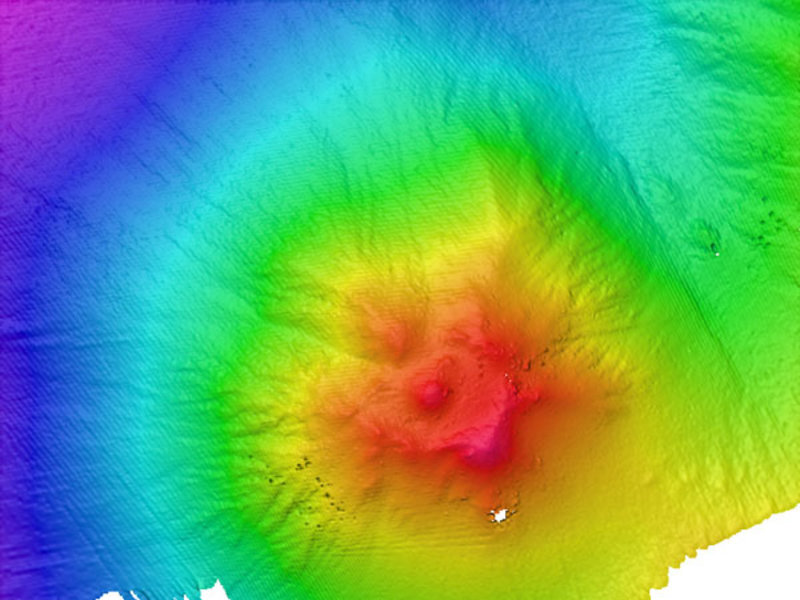
Multibeam map of the Naung site using 20m grid cell size. Personnel used this map to plan the ROV dive. Image courtesy of the NOAA Office of Ocean Exploration and Research, INDEX-SATAL 2010. Download larger version (jpg, 361 KB).

Multibeam map of the Naung site using 20m grid cell size. Personnel used this map to plan the ROV dive. Image courtesy of the NOAA Office of Ocean Exploration and Research, INDEX-SATAL 2010. Download larger version (jpg, 361 KB).
The launch target for EX-1004-Leg II_ROV005 was 3º 46.73’’N 125º 22.18’E. The target is nearby the site termed ‘Naung’ in 2004 paper by McConachy. Multibeam bathymetry revealed a shallow seamount with a central peak and several surrounding lower peaks. CTD casts the previous night indicated hydrothermal activity. The ROV landed downslope of the central peak but was unable to make forward progress in the desired direction due to strong NE to SW current. ROV Operations Coordinator Dave Lovalvo informed the science party of the need to change tactics. He directed the ROV navigator to have the ship ‘tow’ the ROV to a new location up-current to begin the dive. Currents were greatly reduced in the new area and the ROV was able to make headway. The soft sedimented bottom was covered with many ripples and there were often large scour marks around the many rocky outcrops we encountered. The biota of Naung was similar to what we saw in our previous dive, however, this seamount contained a much greater abundance and diversity of organisms. Though the ROV found no evidence of hydrothermal activity, it did capture stunning high-resolution imagery of the various corals, sponges, shrimp, sea cucumbers, and other animals.