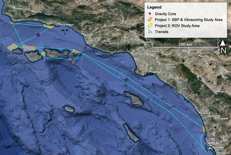
Using chirp and controlled source electromagnetic data collected during geophysical surveys conducted as part of the expedition in October 2021 and March 2022, the research team has identified sites P2A-D for targeted remotely operated vehicle investigations in January 2023.