Image courtesy of National Park Service via Guam: A Biogeographic and Maritime Cultural Landscape Exploration of a WWII Amphibious Battlefield. Download largest version (jpg, 787 KB).
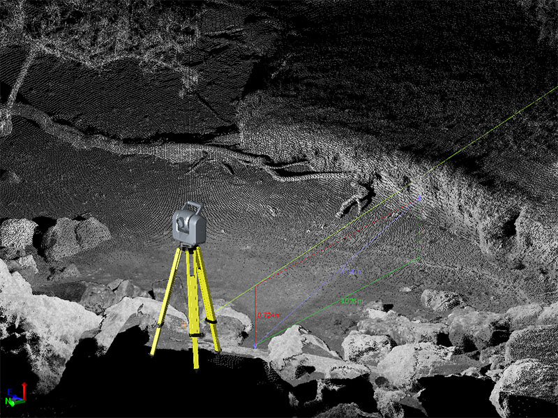
A scanning total station on boulders on the shoreline of Agat facing inland. Using very high-resolution lidar like this enables researchers to measure features and parameters of interest, including erosion of the bank at the shoreline.