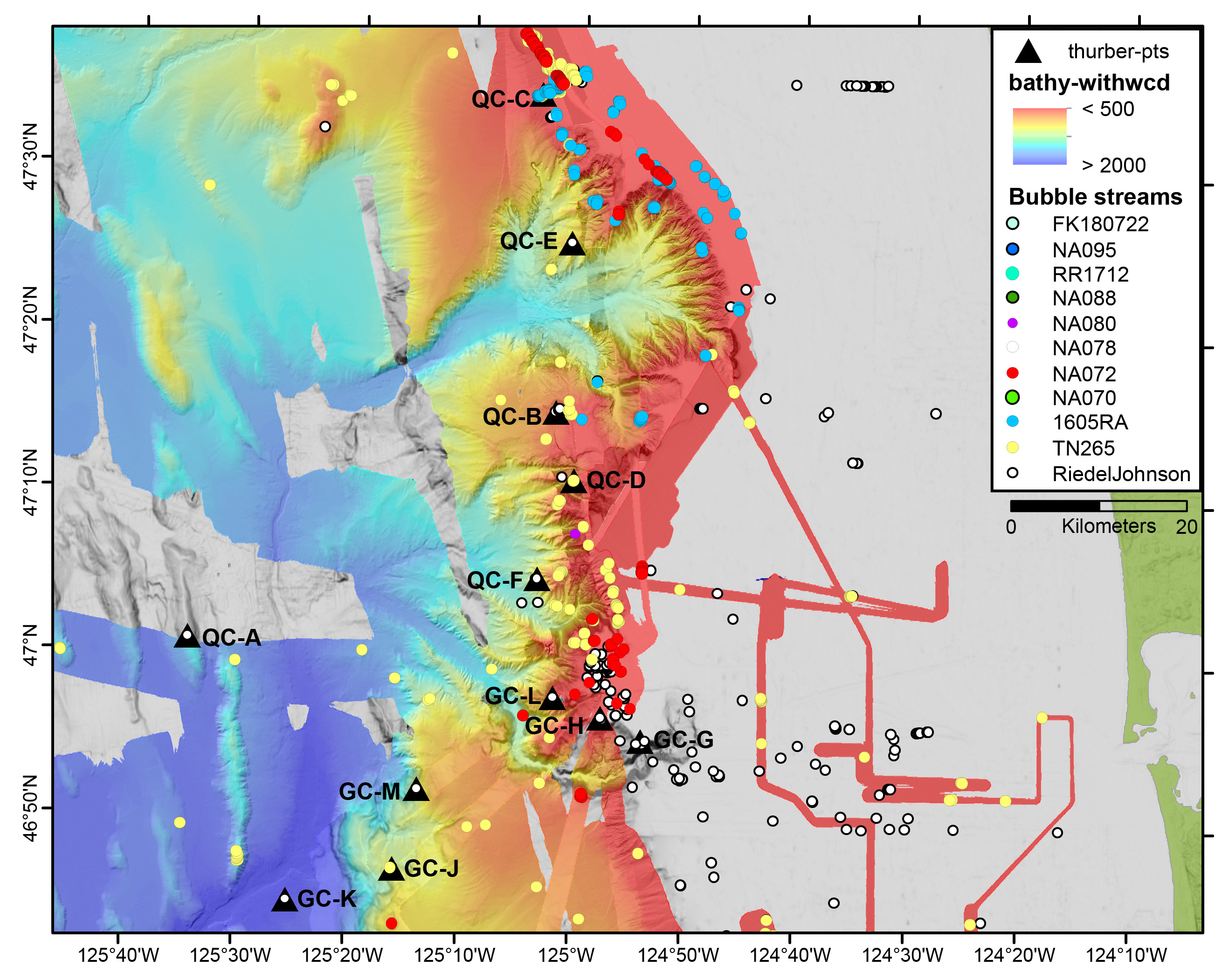
Image courtesy of Susan G. Merle, NOAA EOI Program / Oregon State Univ CIMRS Program and plume data are from Johnson et al. 2019. J Geophys Res, 124: 2829.Download larger version (jpg, 1.6 MB).
Map of the two canyons which we will explore on this expedition. Each dot is an area where a plume of methane is being released from the seafloor. The triangles are potential dive sites that we will visit on this expedition.
