Bathymetric map of seamounts in the Gulf of Alaska. Color show different bottom depth and the white areas indicate regions where the seafloor has not yet been mapped.
Gulf Seamounts
Image courtesy of Steve Roberts, UAF. Download image (jpg, 677 KB).

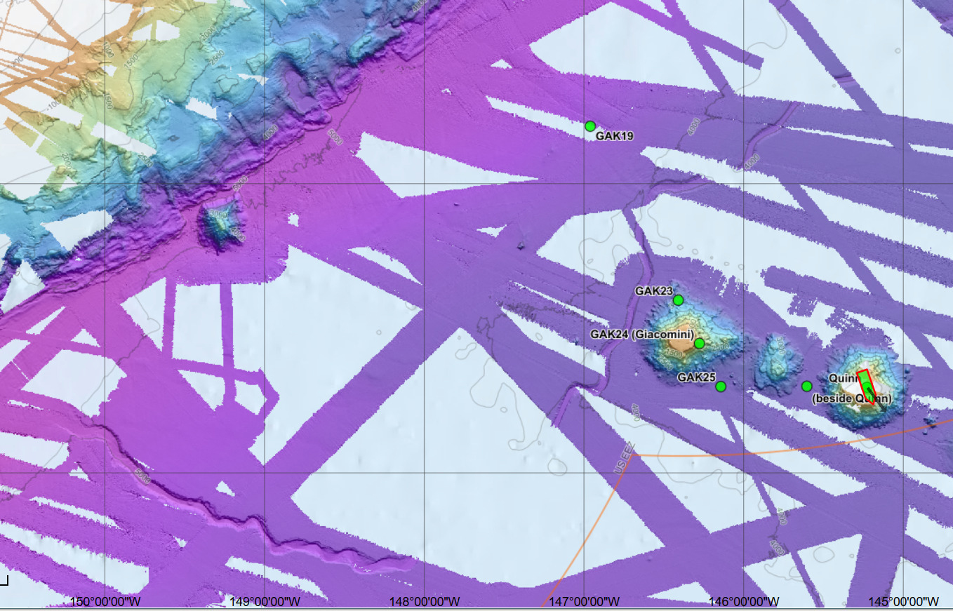
Bathymetric map of seamounts in the Gulf of Alaska. Colors show different bottom depths and the white areas indicate regions where the seafloor has not yet been mapped.

Learn more