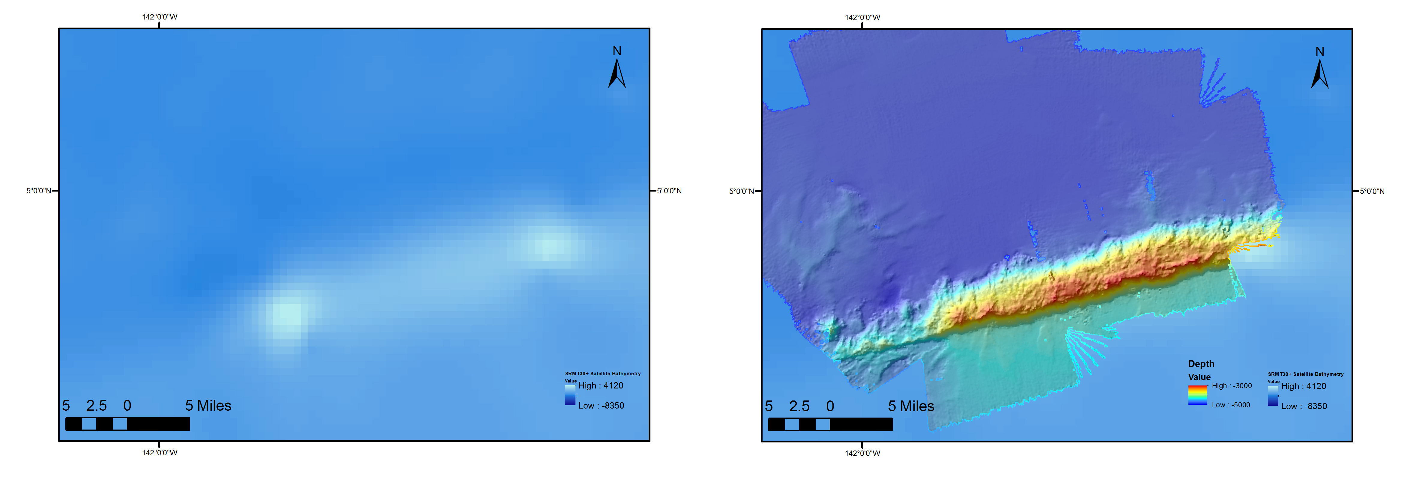
Before (left) and after (right) shots of the seamount of interest. The left map shows estimated bathymetry from satellite. The right area shows the multibeam data we have just finished gathering and processing over the same region.
 and after (right) shots of the seamount of interest. The left map shows estimated bathymetry from satellite. The right area shows the multibeam data we have just finished gathering and processing over the same region.")