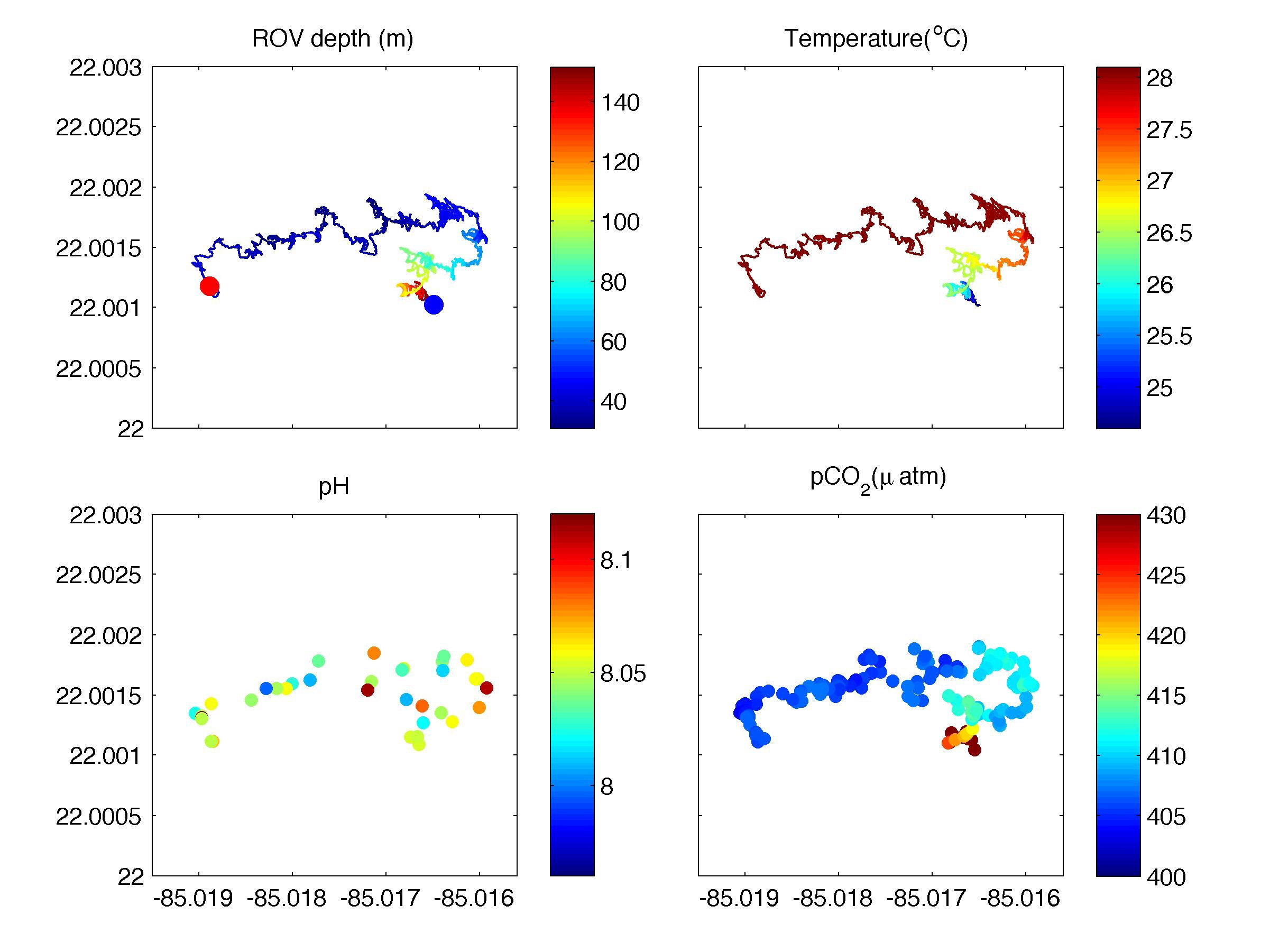
 depth (m), (top right) temperature (°C), (bottom left) pH, and (bottom right) pCO₂ (µatm). Blue and red dots indicate the start and end of the dive. The ROV first dove to around 150 meters at the base of the reef (blue dot in the top left panel), slowly climbed the reef wall and then moved around on top of the reef. Spatially the ROV covered about 300 meters in the west-east direction and less than 100 meters north-south over a period of ~ 3 hours.")
ROV track and the measured parameters from dive 415 on May 21: (top left) depth (m), (top right) temperature (°C), (bottom left) pH, and (bottom right) pCO₂ (µatm). Blue and red dots indicate the start and end of the dive. The ROV first dove to around 150 meters at the base of the reef (blue dot in the top left panel), slowly climbed the reef wall and then moved around on top of the reef. Spatially the ROV covered about 300 meters in the west-east direction and less than 100 meters north-south over a period of ~ 3 hours.