
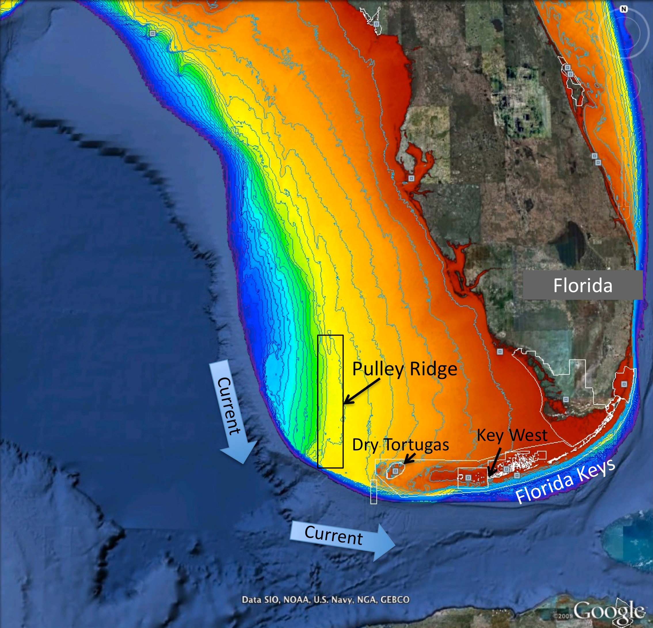
Figure 1. Map of project area showing Pulley Ridge, off the west coast of Florida at depths of 200-330 feet in relation to the downstream refs of the Dry Tortugas and Florida Keys. Colors represent water depth, which ranges from 33 feet (red) to depths of 820 feet or greater (dark blue). Current arrows depict prevalent current direction. Background image is from Google Earth and the depth information is from the U.S. Geological Survey and NOAA.