
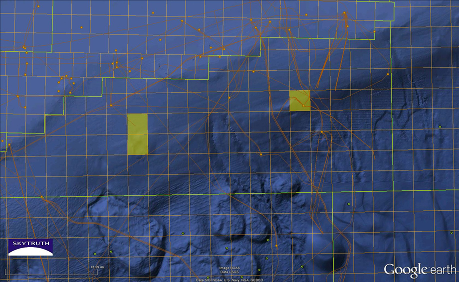
This map shows the Viosca Knoll area of the Gulf, where the most developed natural Lophelia reefs exist. (VK-826 in yellow square on right and VK-862/906 on left). The orange dots are oil platforms and the orange lines represent pipelines. There are numerous platforms in close proximity to the VK reefs. Natural cold seep sites greater than 1,000 meters depth are shown in green.