


2026 American Samoa ROV + Mapping Exploration
SOUP: A Recipe for Managing Data from the Abyss to Archive
Every sample collected during expeditions on NOAA Ship Okeanos Explorer contributes to a greater understanding of the data-scarce deep ocean. To enhance the integrity of the data associated with these samples, NOAA’s National Centers for Environmental Information (NCEI) developed a new, modern sampling data management system. Installed on the ship at the beginning of the 2026 field season, the system is now part of regular operations.


This glass sponge (Dictyaulus sp.) was collected from a large crater at the top of a seamount during Dive 01 of the 2026 American Samoa ROV + Mapping Exploration expedition. The image on the right shows it in the wet lab of NOAA Ship Okeanos Explorer during processing and entry into the Sampling Operations User Portal (SOUP). Images courtesy of NOAA Ocean Exploration, 2026 American Samoa ROV + Mapping Exploration. Download largest version on the left (jpg, 946 KB). Download largest version on the right (jpg, 878 KB).
The Sampling Operations User Portal (SOUP) is a cloud-based application with a robust back-end database designed to store, manage, and maintain information about physical samples collected from the deep sea during expeditions on Okeanos Explorer.
NOAA Ocean Exploration designs these expeditions using their “Explorer Model,” which integrates ocean science and resource management through a community-driven approach to explore and characterize the deep sea. Exploration sampling plays a critical role in these efforts by collecting biological, geological, and water samples that provide the data needed to assess genetic diversity, morphology, ecological connectivity, taxonomy, and seafloor composition within areas of interest. NCEI plays a key role in this process by managing and preserving the data on these precious samples throughout their lifecycle, from collection and processing to facilitation of long-term archiving and public access.

This scoop of polymetallic crust was collected from a small ridge structure on a seamount during Dive 01 of the 2026 American Samoa ROV + Mapping Exploration expedition. The color checker is included in the photo to help document changes in mineralogy that may occur when the sample is exposed to air and warmer temperatures. Image courtesy of NOAA Ocean Exploration, 2026 American Samoa ROV + Mapping Exploration. Download largest version (jpg, 1 MB).
During expeditions on Okeanos Explorer, biological, geological, and water samples are collected using a variety of tools on remotely operated vehicle (ROV) Deep Discoverer. Water samples are also collected using conductivity, temperature, and depth (CTD) rosette systems.

Margaret Hanley (left) and Treyson Gillespie (right) retrieve water samples from remotely operated vehicle Deep Discoverer after a dive during the 2026 American Samoa ROV + Mapping Exploration expedition. Image courtesy of NOAA Ocean Exploration, 2026 American Samoa ROV + Mapping Exploration. Download largest version (jpg, 210 KB).

The conductivity, temperature, and depth (CTD) rosette system is deployed from the deck of NOAA Ship Okeanos Explorer to collect water samples for environmental DNA (eDNA) analysis and other purposes. Image courtesy of NOAA Ocean Exploration, 2026 Pacific Islands Mapping. Download largest version (jpg, 837 KB).
After collection and once on the ship’s deck, samples are processed based on the objective for which they were collected. For example,
- A coral sample may be subsampled to enable both genetic and morphological analysis.
- A rock may be measured and packaged for mineral analysis on shore.
- A water sample may be filtered for environmental DNA (eDNA).
Environmental metadata for each sample are logged in SOUP and can include latitude and longitude, depth, temperature, salinity, dissolved oxygen, and in situ imagery from the time of collection.
SOUP takes onboard data processing to new depths with its streamlined user interface and integration into ship-based data recording software. With the simple click of a button, a user can ingest sampling metadata, print museum quality labels, generate summary exports and reports, and so much more. Through automation processes and network-based pipelines, SOUP simplifies the sampling workflow, allowing for easier and faster data backup, remote access, and fewer errors.
During the 2026 ROV Shakedown expedition, SOUP was installed on NOAA Ocean Exploration’s new science-dedicated network, integrated into the workflow of the systems from which it pulls data, and tested to ensure all issues were addressed before the official beginning of the field season on Okeanos Explorer.
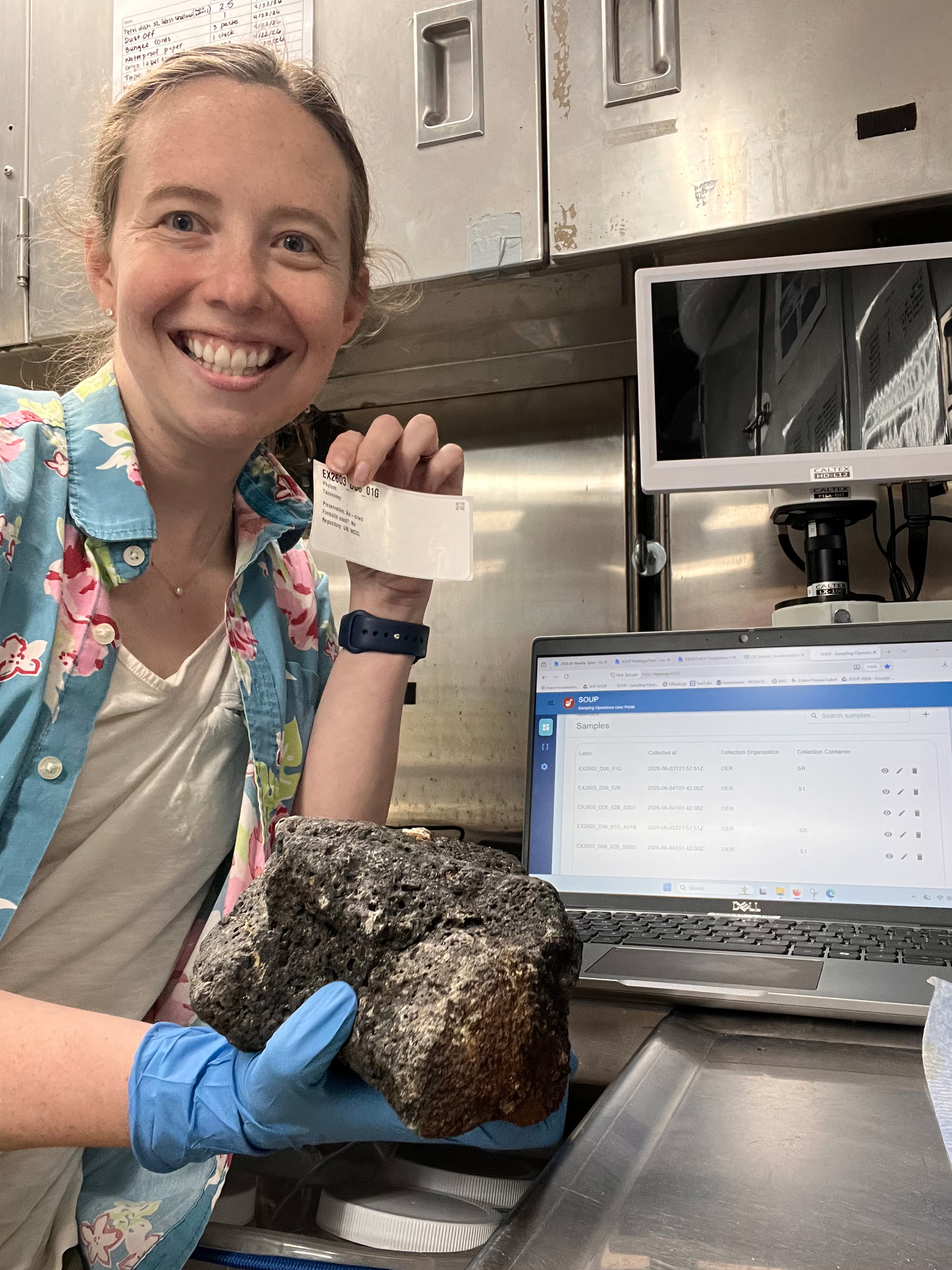
Anna Lienesch was a sample data manager on the 2026 ROV Shakedown expedition, when the Sampling Operations User Portal (SOUP) was first installed. Here she shows off the first official sample documented with the SOUP application (a rock), the SOUP interface, and the first printed SOUP label. Image courtesy of NOAA Ocean Exploration, 2026 American Samoa ROV + Mapping Exploration. Download largest version (jpg, 2 MB).
Looking ahead, NCEI may further develop SOUP for use on other projects, replacing outdated workflows and streamlining processes.
Samples can be accessed at NOAA Ocean Exploration’s designated sample repositories.
NCEI maintains customized data access portals that provide centralized access to NOAA Ocean Exploration data collections. Data, derived products, and related information from exploration expeditions are archived and made publicly available through NCEI’s data portals and expedition-specific data access landing pages.
By Jennifer Green, Jessie Heise, Anna Lienesch, Robert Ward, David Sallis, and Connor Cayson, NOAA’s National Centers for Environmental Information