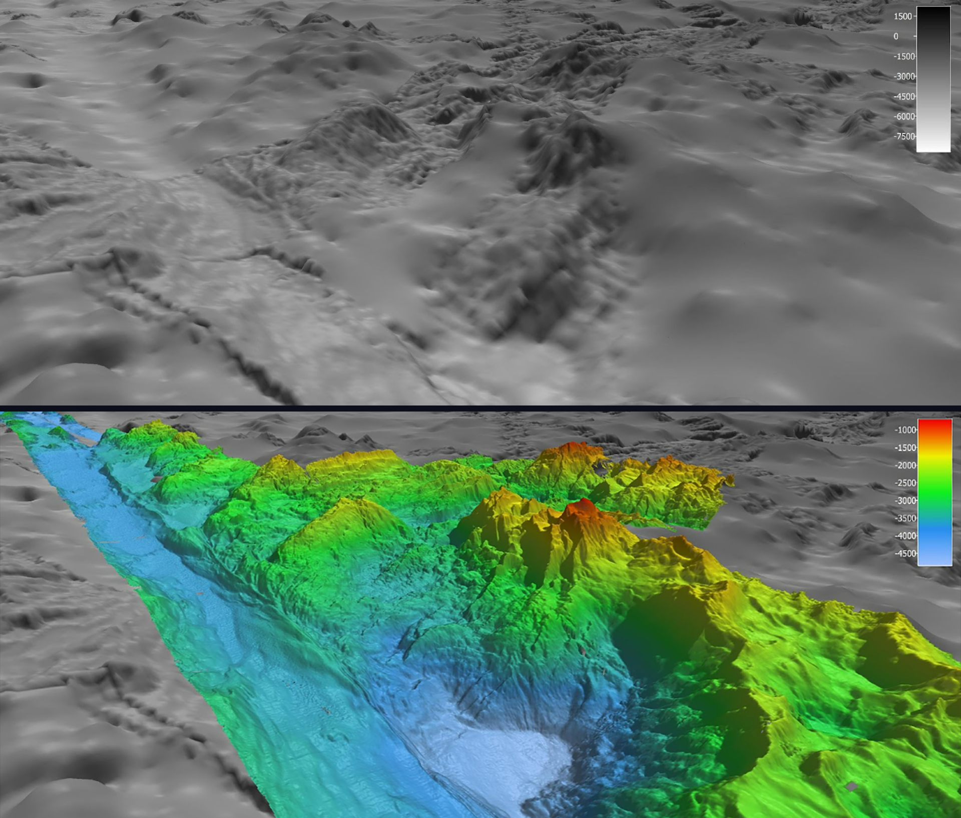
 in comparison to the high-resolution bathymetry data (bottom) collected during Voyage to the Ridge 2022 using the multibeam system on NOAA Ship Okeanos Explorer.")
In May, during the first Voyage to the Ridge 2022 expedition, NOAA Ocean Exploration completed the largest continuous mapping survey effort to date over the Charlie-Gibbs Fracture Zone, collecting bathymetric data along this geologically fascinating and ecologically exceptional region. These images show satellite-derived bathymetry data (top) in comparison to the high-resolution bathymetry data (bottom) collected during Voyage to the Ridge 2022 using the multibeam system on NOAA Ship Okeanos Explorer.