Instructions: Review the animation and images below and then scroll down to answer the questions that follow.
The National Oceanographic and Atmospheric Administration has deployed a series of Deep Ocean Assessment and Reporting of Tsunami (DART) buoys in the Pacific Ocean as part of their system to detect the deadly waves.
|
|
Sensors on the sea floor relay suspicious pressure changes to a surface buoy, which sends the data to NOAA's tsunami warning centers. Scientists analyze the information, and issue tsunami alerts to authorities in threatened areas. Click 'play' to see the animation
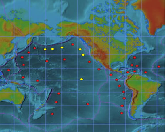
Yellow dots mark the location of existing DART buoys. Red dots are buoys proposed for an expanded tsunami monitoring system.
Many Pacific coast communities have developed tsunami educational programs and emergency plans.
Now, answer the questions below.
The Pacific Ocean is the site of violent geologic events. Its edge is called the Ring of Fire, because it is lined by active volcanoes. Strong earthquakes are common. All this tectonic activity makes tsunami more frequent in the Pacific than in the Atlantic. And countries on the North Pacific rim, like the United States and Japan, had the financial and technological means to develop, install, and maintain a system of warning buoys.
Since these sensors were put in place, geologists have learned that the east coast is also vulnerable to tsunami, mainly due to enormous undersea landslides. And the 2004 event made it clear that the humanitarian and financial costs of tsunami in other parts of the world justify expanding the system to cover even those countries that cannot pay to participate.