

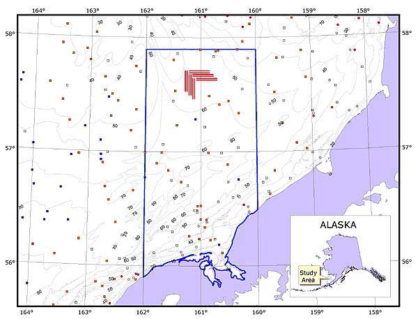
Location of the Next Generation Tools study area in the Bristol Bay region of the eastern Bering Sea. Side scan sonar evaluations were conducted in 12 corridors (shown in red), each approximately 100 m wide and 20 km long. Field operations were intentionally conducted in the rather pristine Red King Crab Savings Area (blue outlined area), because of the longstanding closure to commercial bottom trawling. Although this is an area of considerable ecological importance, even basic environmental information, such as water depths and seabed types, is generally lacking and of low quality. Additional hydrographic survey work in the forseeable future is unlikely due to the remote nature of the area and the lack of significant deeper draft commercial vessel traffic. Image courtesy of Next Generation Tools 2001, NOAA-OER.