
By Bryan Brasher, Safety Officer ENS - NOAA
Jeff Laning, ROV Engineer - GFOE
James Scott, Deck Lead AB - NOAA
Amy Bowman, Web Coordinator - NOAA
May 12, 2017
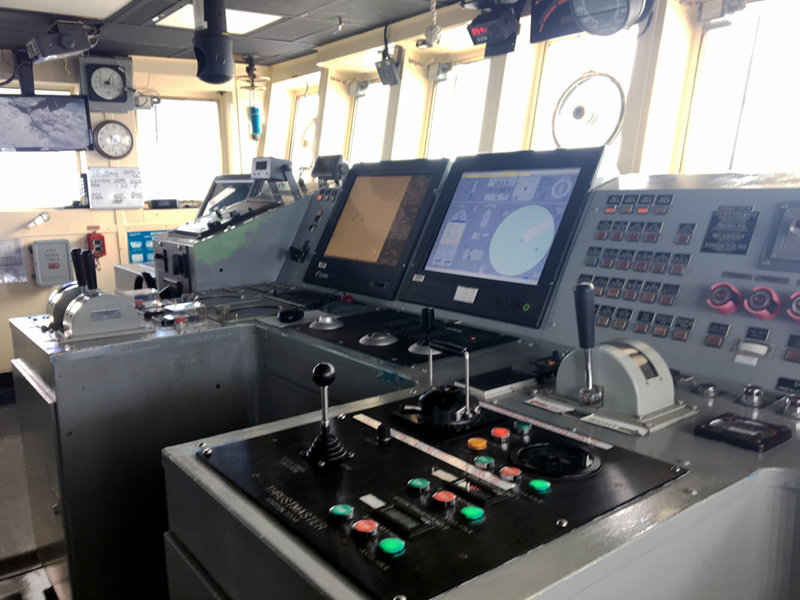
The Dynamic Position controls are on the bridge on NOAA Ship Okeanos Explorer. Image courtesy of the NOAA Office of Ocean Exploration and Research, Mountains in the Deep: Exploring the Central Pacific Basin. Download larger version (jpg, 4.3 MB).
As American author Tom Robbins said in a 1976 novel, "True stability results when presumed order and presumed disorder are balanced. A truly stable system expects the unexpected, is prepared to be disrupted, waits to be transformed." So what does it take to keep our entire system stable in order to get the up-close, high-definition imagery that NOAA Ship Okeanos Explorer shares with the world?
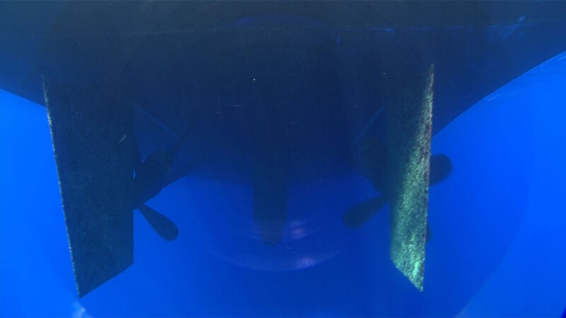
The propellers on NOAA Ship Okeanos Explorer. Image courtesy of the NOAA Office of Ocean Exploration and Research, Discovering the Deep: Exploring Remote Pacific MPAs. Download larger version (jpg, 270 KB).
If you have ever been on a boat, or floated on the surface of the sea, you know the ocean is always in motion. Have you ever wondered how a remotely operated vehicle (ROV) like Deep Discoverer (D2) is able to stay in position, even though attached to a rocking ship? During ROV operations, D2 has to be able to navigate the bottom of the ocean while the ship is subjected to the forces of the ocean and wind on the surface. To make this possible, the ship must hold its position with respect to the seafloor while combating those external forces. In addition, the dual-body (D2 plus Seirios) ROV system must work together to hold position.
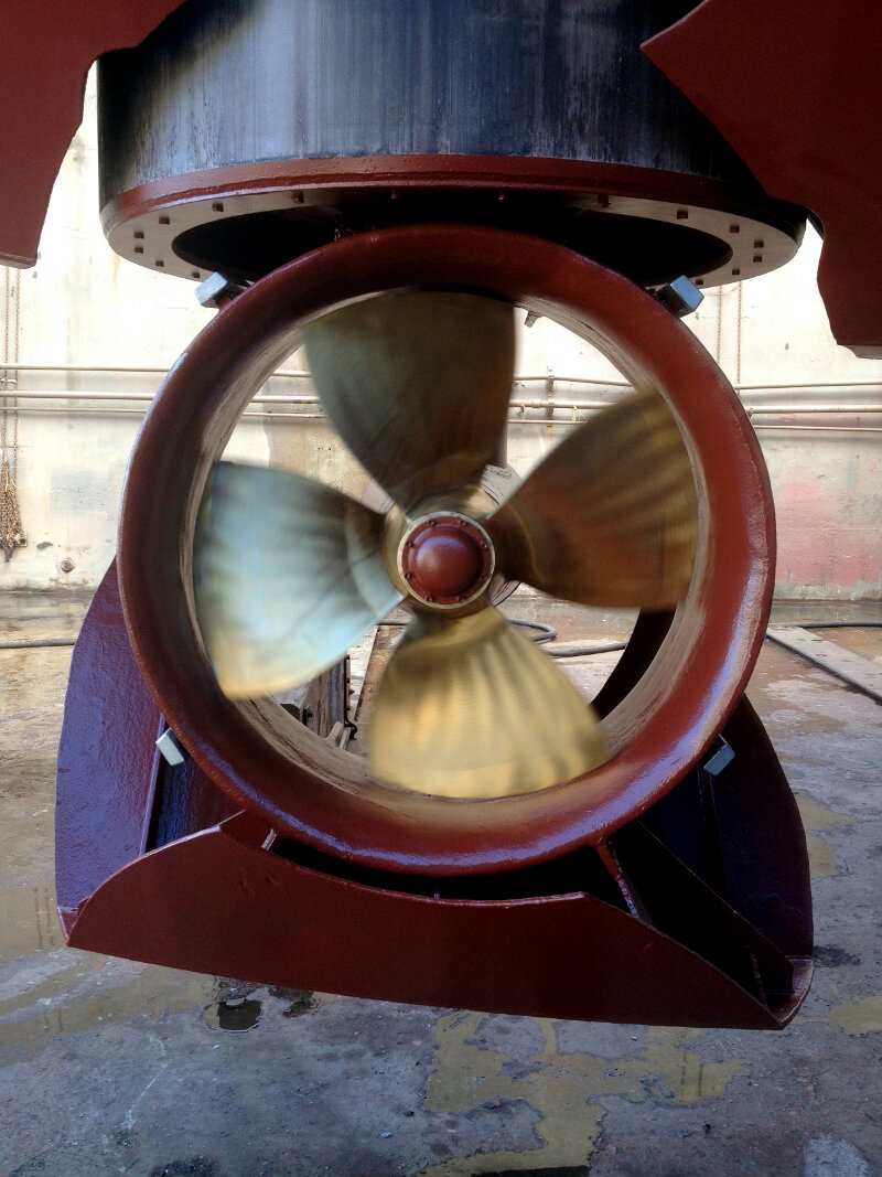
This bow thruster retracts into the ship. Notice the plating on the bottom, it is representative of the hull of the ship. We can either lower it or operate it inside the hull. Image courtesy of Tim Monaghan. Download larger version (jpg, 4.0 MB).
NOAA Ship Okeanos Explorer uses a computer-controlled dynamic positioning (DP) system to hold and precisely adjust its position within 0.5-meter (1.65-foot) accuracy. By controlling the ship's propulsion system – two eight-foot propellers with 1,600 shaft horsepower, two 250 horsepower tunnel thrusters located on the stern, and a single 550 horsepower azimuthing thruster that can rotate 360 degrees located on the bow – the DP system is able to balance and control forces acting on the vessel.
Ships have six degrees of freedom:
Heave, pitch, and roll movements are a function of external forces acting on the vessel and the ship's stability and buoyancy in the water. Maintaining position requires that the DP system only be concerned with controlling movement in the horizontal plane (i.e., sway, surge, and yaw).
The DP system relies on accurate inputs about the ship's location and the environment in which it is operating to determine the magnitude and direction of thrust required. The failure of any one of these sensors will severely degrade the system's ability to hold position and can easily endanger the vehicles operating near the seafloor.
Before the DP system can begin its calculations, it must first identify the location and heading of the vessel. Due to the remoteness of our operating area and the depths involved, NOAA Ship Okeanos Explorer can not use relative positions and relies upon global navigation satellite systems (GNSS) to reference the ship's location on the surface of the Earth. The ship's three GNSS receivers are capable of receiving geolocation information from any of the major satellite constellations, but generally use the U.S.-based Differential Global Positioning System (DGPS) – an enhancement to regular GPS that increases accuracy, in some cases from 15 meters to 10 centimeters (50 feet to 4 inches).
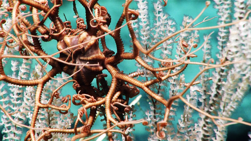
A tight zoom of a basket star on a primnoid coral taken on Dive 11 of the Mountains in the Deep expedition. Image courtesy of the NOAA Office of Ocean Exploration and Research, Mountains in the Deep: Exploring the Central Pacific Basin. Download larger version (jpg, 1.6 MB).
By receiving corrections transmitted from known and fixed locations around the world, these GPS receivers can determine the ship's location to within 0.1 meter (4 inches) of accuracy under ideal conditions. The heading of the vessel is determined by the ship's two gyrocompasses. Gyrocompasses are non-magnetic compasses that find true North as determined by the Earth's rotation.
Once the position of the vessel is identified, the DP system must then estimate the external forces acting on the vessel. At its highest point, NOAA Ship Okeanos Explorer reaches nearly 21 meters (70 feet) into the air. With such a large surface area, even a small amount of wind can exert relatively large forces on the the ship. The effect of wind is calculated using a mathematical model of the ship, the ship’s heading, and the speed of the wind as measured by two anemometers (an instrument specifically designed for measuring wind speed and direction).
When dynamic positioning is activated, the computer will automatically apply thrust to counteract changing winds. Besides wind inputs, the DP system requires information on how the ship is behaving on the sea surface. Heave, pitch, and roll metrics are provided from fiber optic accelerometers located at the geometric center of the ship. This information allows the system to account for the perceived movement of the boat as it rocks about on the waves. And finally, surface current is calculated by comparing how the ship is actually moving in space to how the ship should be behaving given the mathematical model, measured wind forces, and known power being applied to the ship's propulsion.
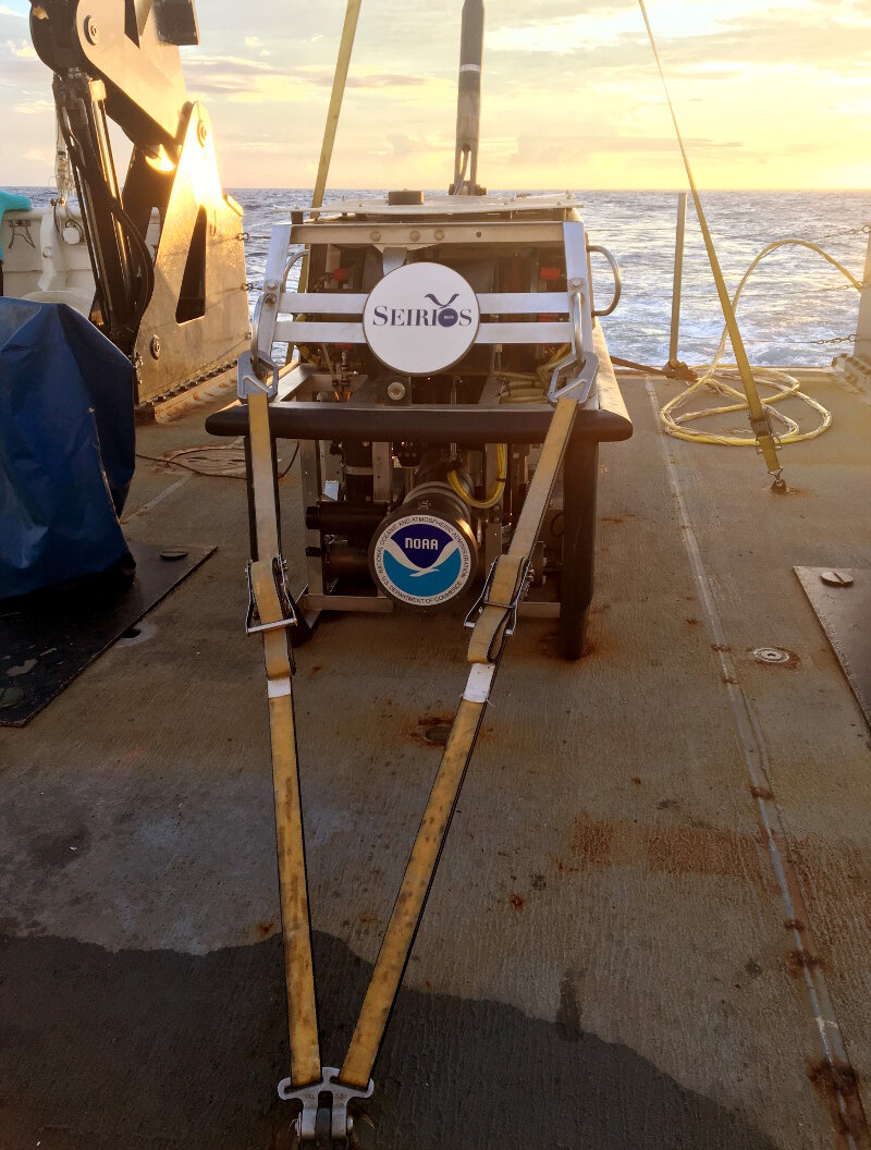
ROV Seirios, the other half of the NOAA Ship Okeanos Explorer dual-body system. Image courtesy of Tim Monaghan. Download larger version (jpg, 6.7 MB).
On NOAA Ship Okeanos Explorer, we operate what is called a two-bodied ROV system, meaning we deploy two ROVs at once. Although they are both considered ROVs, they have very different purposes. Starting at the ship, spooled on a winch, is an eight-kilometer (approximately five-mile) long steel cable containing copper conductors and fiber optic cables – carrying power and communications – from which Seirios hangs.
Seirios, the first ROV in the chain, has no buoyancy and weighs roughly 1,134 kilograms (2,500 pounds). Seirios itself only has control over its heading, or yaw in ship terms, using two thrusters. To move this ROV axially or laterally, we must ask the ship to move its position. To move vertically, we must haul in or lay out cable. This means when the ship heaves, so does Seirios. The purpose of this ROV is not up-close inspection of the deep ocean, but rather it is a tool to help pilots fly D2, providing spatial awareness with a third-person view.
D2 is connected to Seirios via a 30-meter (~98-foot) neutrally buoyant cable – effectively isolating D2 from the ship's (and Seirios') motions. D2 is buoyant. Thus, pilots can use four degrees of freedom by using six thrusters – two vertically mounted, two axially mounted, two laterally mounted. By using the axial and lateral thrusters together, pilots can change the heading of the vehicle. The pilots do not have control over pitch or roll. These are mitigated by mounting the positive buoyancy of the vehicle high. If you look at a picture of D2, the white, positively buoyant blocks are mounted on top, making D2 inherently stable.
Adding these degrees of freedom means that D2 is subject to ocean current forces on the bottom of the ocean similar to the ship on the surface. D2 does have some "autopilot" functions, but they are not typically used in normal deep-ocean exploration scenarios. Normally, the pilots manually balance those forces while operating D2 on the bottom of the ocean. Given D2's lower inertia and higher thrust to mass ratio, the ROV is more responsive then the ship and much easier to manage manually. The other huge advantage is, since it is subsea and has vertical control, we are able to land D2 on the bottom of the ocean – effectively anchoring the vehicle and providing a very stable platform to enable stable videography and close-ups.
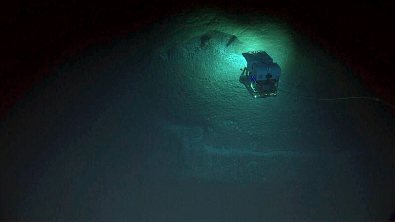
ROV Deep Discoverer on a steep wall at the Aunuʻu Unit of National Marine Sanctuary of American Samoa. Image courtesy of the NOAA Office of Ocean Exploration and Research, Mountains in the Deep: Exploring the Central Pacific Basin. Download larger version (jpg, 451 KB).
Especially with dives on steep walls, like our deepwater exploration of the Aunuʻu Unit of National Marine Sanctuary American Samoa, all of these systems, and all of the teams – including the bridge, deck, engineers, and scientists – work together. Maintaining constant communications is crucial. On that dive, like all of our ROV dives, everyone worked in concert to maintain position, allowing D2 to collect beautiful close-up imagery while making everything look seamless.