
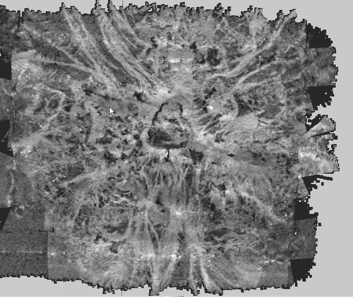
This image, from data collected during the CAPSTONE Telepresence Mapping in Pacific Marine Protected Areas expedition, shows a seamount that was once volcanically active. The brighter color indicates harder surfaces from more recent volcanic activity, while the darker areas indicate sediment that has been deposited between volcanic flows. In addition to being used for scientific interpretations, these images are being used for our current cruise to plan dives in the Jarvis Unit of the Pacific Remote Islands Marine National Monument.