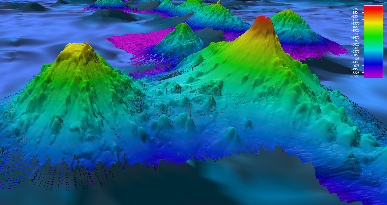
 and an unnamed guyot (left) shows one example of nearby seamounts with very different geomorphology. Pao Pao Seamount comes to a very sharp peak at around 300 meters and shows steep flanks while the unnamed feature has a distinct flat top. Biological communities we find on these features may differ greatly at similar depth intervals despite being only 25 kilometers apart from each other.")
Multibeam bathymetry of Pao Pao Seamount (right) and an unnamed guyot (left) shows one example of nearby seamounts with very different geomorphology. Pao Pao Seamount comes to a very sharp peak at around 300 meters and shows steep flanks while the unnamed feature has a distinct flat top. Biological communities we find on these features may differ greatly at similar depth intervals despite being only 25 kilometers apart from each other. Image courtesy of the NOAA Office of Ocean Exploration and Research, Discovering the Deep: Exploring Remote Pacific MPAs. Download larger version (jpg, 810 KB).