By Marah Dahn, Mapping Explorer in Training

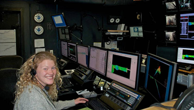
Marah Dahn gets hands-on seafloor mapping experience in the control room of NOAA Ship Okeanos Explorer. Image courtesy of the NOAA Office of Ocean Exploration and Research, Exploration of the Gulf of Mexico 2014. Download image (jpg, 53 KB).
My name is Marah Dahn and I’m one of three mapping "explorers in training" on the NOAA Ship Okeanos Explorer right now. I earned my undergraduate degree in Geophysics in December and plan to attend graduate school in the fall for Geophysical Oceanography. In the meantime, I wanted firsthand experience gathering data at sea, so I applied for the Okeanos Explorer mapping experience. I was selected to sail as an intern on the Leg 2 of the Gulf of Mexico 2014 expedition, which is a 19-day mapping cruise.
We left Galveston, Texas, on March 19, and since then we have been mapping the seafloor in the Gulf of Mexico 24 hours a day. We’re acquiring multi-beam, single-beam, backscatter, and sub-bottom data all at the same time.
Each trainee sits a daily eight-hour watch with a Mapping Watch Lead. My shift is from 4 pm to midnight with my Watch Lead, Erin. While I’m on watch, I monitor the sonars on several different computer screens, conduct casts to measure sound speed, and process data as it’s collected.

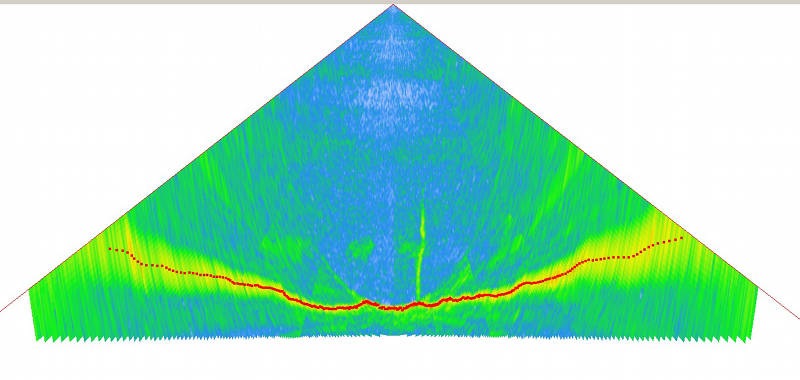
Gas seeps seen on the multibeam profile. Image courtesy of the NOAA Office of Ocean Exploration and Research, Exploration of the Gulf of Mexico 2014. Download larger version (jpg, 496 MB).
On my first watch, I got to see a seep garden, or multiple seeps! First, we noticed it in the water column backscatter—we could see potential methane bubbles. Then we also got to see it in the multibeam profile. We’ve seen five more clusters of seeps since then and are on the lookout for more.
So far on the Okeanos Explorer I’ve learned a ton about acquiring and processing data and am having a great time.

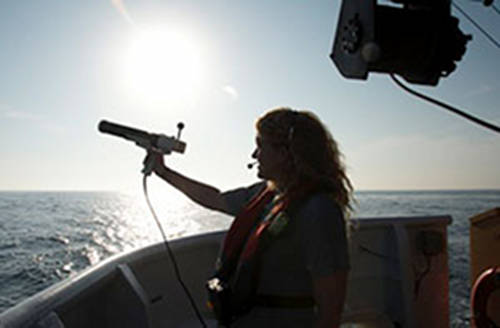
Marah launches the XBT cast from the deck of the Okeanos Explorer. Image courtesy of the NOAA Office of Ocean Exploration and Research, Exploration of the Gulf of Mexico 2014. Download image (jpg, 17 KB).
In order to make accurate depth measurements with the multibeam sonar, we need to know how fast the acoustic pressure wave travels through seawater. The speed at which sound travels changes as the density of water varies through the water column. Temperature and salinity are the two main variables that affect the density of seawater.
On the Okeanos Explorer, we measure water column temperatures using an Expendable Bathythermograph (XBT) cast and use surface salinity values from a thermo-salino-graph (TSG). These are used together to determine an overall sound speed profile. An XBT is a small probe that is deployed into the water using a hand-held launcher. Through a thin copper wire, it transmits temperature readings back to the ship’s computers. The TSG measures the salinity and temperature at the water surface. We use software to calculate sound speed from the XBT and TSG readings. The sound speed values are then applied to the multibeam soundings in real-time.
An XBT cast is performed every three hours. Conducting a cast is a nice way to get outside and enjoy the fresh air and maybe see some flying fish. Casts are particularly enjoyable during during sunrise or sunset!