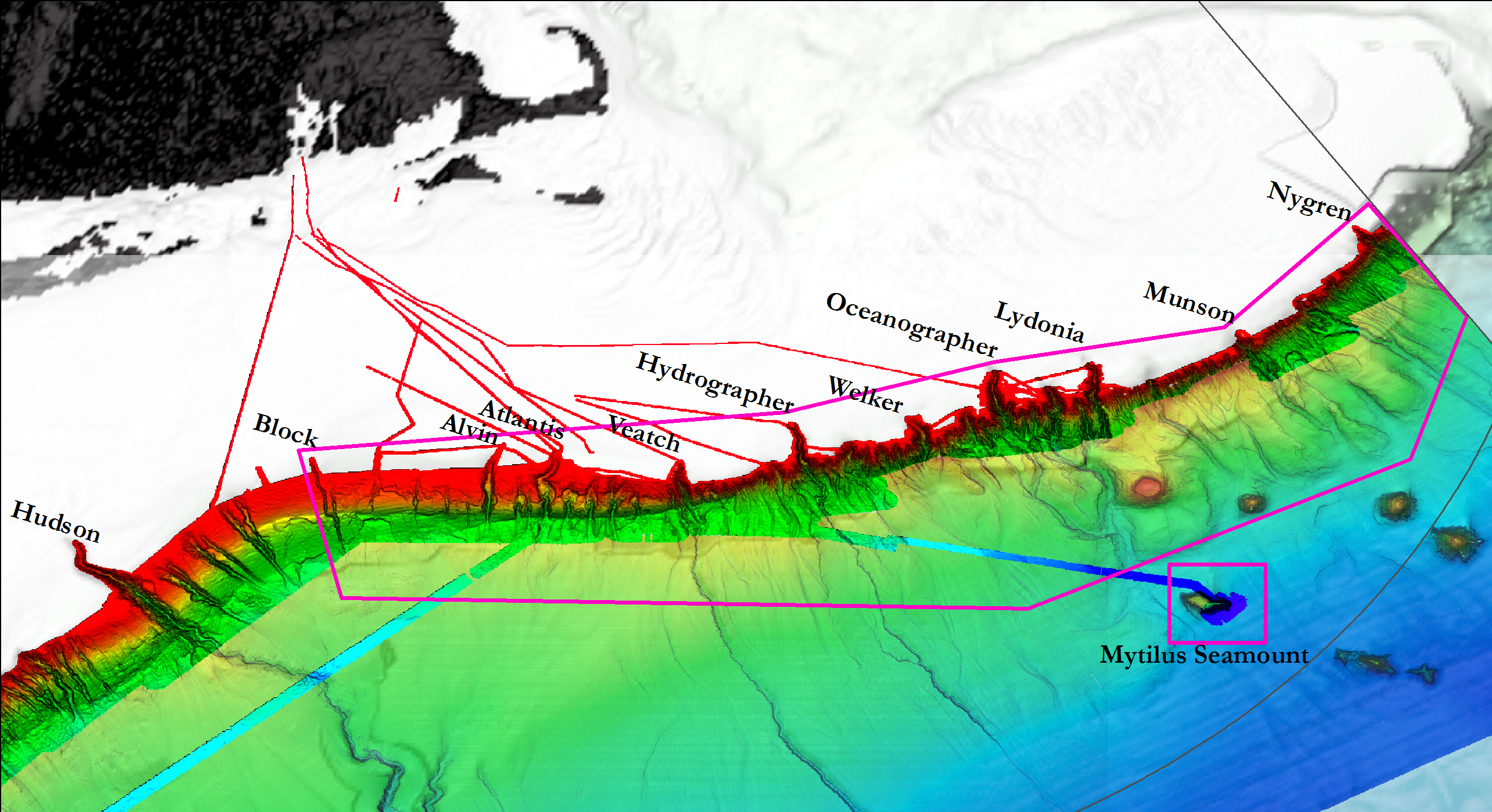
Map showing submarine canyon and seamount areas expected to be explored during the
Okeanos Explorer Northeast U.S. Canyons Expedition 2013. The operating areas encompass input from the NOAA Deep Sea Coral Research and Technology Program, NOAA Office of National Marine Sanctuaries, the Northeast Fisheries Management Council, Northeast Regional Council on the Ocean, Mid-Atlantic Regional Council on the Ocean states, and the U.S. Geological Survey. The grey line is the U.S. Exclusive Economic Zone. Underlying seafloor bathymetry shows the northern portion of the U.S. continental margin to the abyss with shallow areas in red to the deepest areas shown in blue. Bathymetry data acquired during surveys conducted from 2004-2013.
Download larger version.