back banner
back button
spacer
ocean explorer home pageNOAA home page

Historical 3-D map of Astoria Canyon


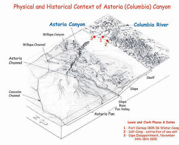
Had Lewis and Clark made their expedition at a time of lower sea levels, their journey along the Columbia River could have take them to the edge of Astoria Canyon. However, their westward push stopped ten miles short at Fort Clatsop where the modern day mouth of the Columbia meets the Pacific Ocean.


Related Links

Lewis and Clark Legacy: Mission Plan

Maps Photo Gallery


E-mail Updates | User Survey | Report Error On This Page | Site Index | Contact Us
Revised July 12, 2005 by the Ocean Explorer Webmaster
National Oceanic and Atmospheric Administration | U.S. Department of Commerce
NOAA Logo Commerce Logo
http://oceanexplorer.noaa.gov/explorations/lewis_clark01/background/plan/media/threed_astoriacanyon.html