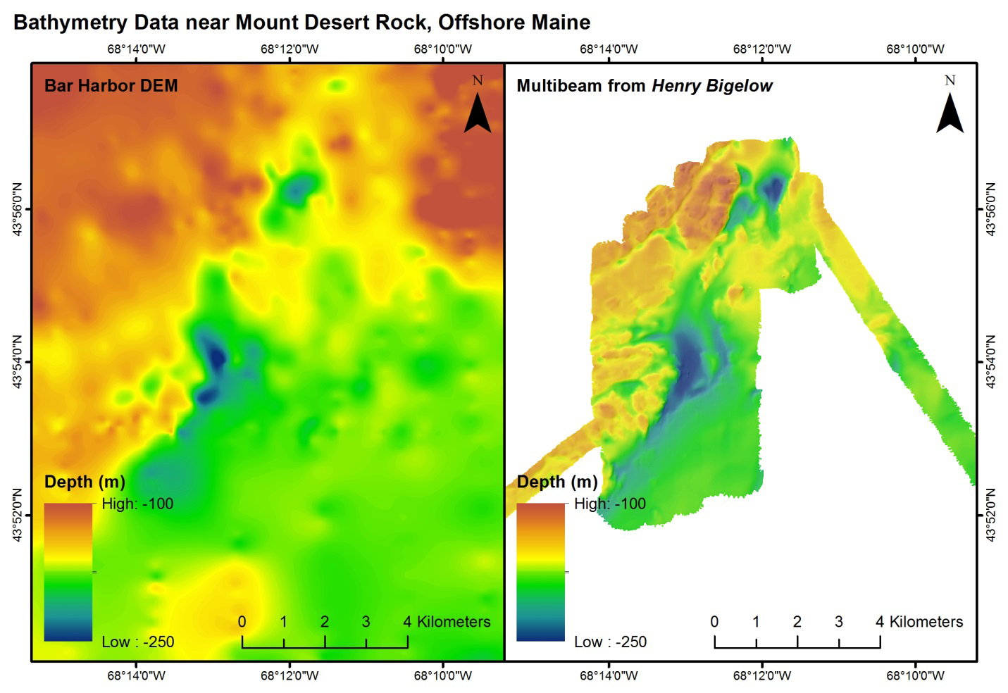
Multibeam bathymetric maps of the seafloor near Mount Desert Rock in the Gulf of Maine, an area that has known coral gardens. Map on the left is an older multibeam map of the area; the higher-resolution, more detailed map on the right is the result of the latest multibeam mapping by the
Bigelow. Warmer colors (reds) indicate higher topographic relief (shallower depths, and often an indication of hard bottom), colder colors (blue) indicate lower topographical relief (deeper depths, and often an indication of soft or muddy bottoms). Deep-sea corals gardens in the Gulf of Maine tend to be found in areas of higher topographic relief.
Download larger version. indicate higher topographic relief (shallower depths, and often an indication of hard bottom), colder colors (blue) indicate lower topographical relief (deeper depths, and often an indication of soft or muddy bottoms). Deep-sea corals gardens in the Gulf of Maine tend to be found in areas of higher topographic relief.")