
By Dr. Carl Kaiser, AUV Program Manager, Woods Hole Oceanographic Institution
August 26, 2016
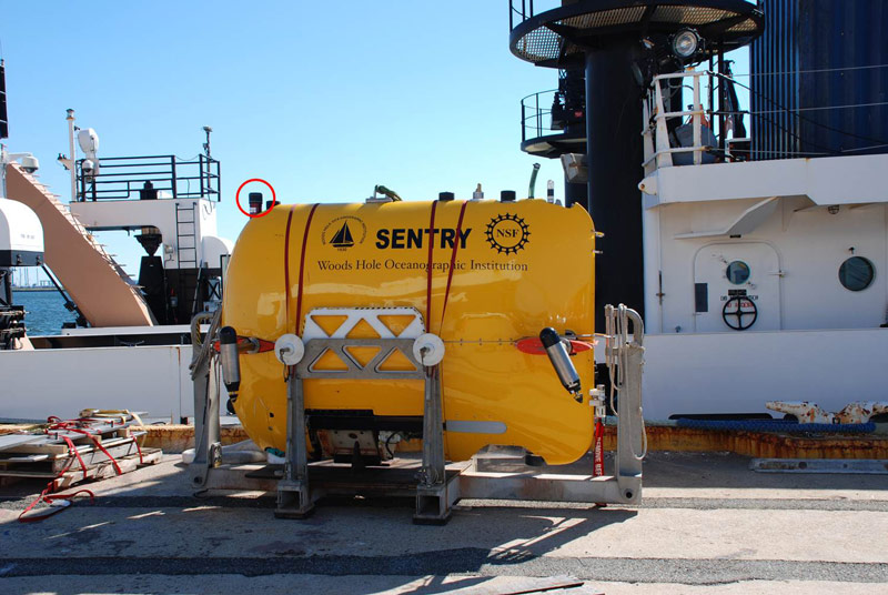
The transponder on Sentry is circled in red. Image courtesy of the Exploring Carolina Canyons expedition. Download larger version (jpg, 539 KB).
Radio signals do not effectively penetrate water. This means that normal navigation systems such as the Global Positioning System (GPS) do not work for submersibles, such as the autonomous underwater vehicle (AUV) Sentry.
The main method used to track and communicate with submersibles is sound. Sentry uses a sound-based navigation system called Ultra Short Baseline (USBL). A piece of the system is on the ship and a piece is on Sentry. The piece on the ship, called a transceiver, sends out a signal into the water. Despite being as much as six kilometers away, the piece of the USBL on Sentry—called a transponder—can hear this signal and responds a precise amount of time later.
When the transponder’s reply arrives back at the ship, it is received by eight receivers inside the transceiver. Even though the receivers are less than a foot apart, the transceiver is able to determine the time difference between them. Using trigonometry, the angles to the vehicle can be computed. Then the distance of Sentry from the ship is computed using the speed of sound through water and the time it took the reply to arrive back at the transceiver.
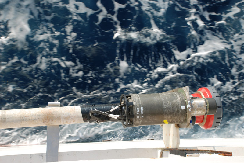
A close-up look at the transceiver (red cylinder) and the fiber optic gyro (large grey cylinder). Image courtesy of the Exploring Carolina Canyons expedition. Download larger version (jpg, 3.7 MB).
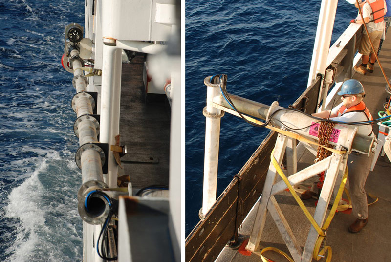
Left: While underway, the transceiver is secured to the side of the ship. Right: The transceiver is lowered into the water when in use. Image courtesy of the Exploring Carolina Canyons expedition. Download larger version (jpg, 1 MB).
Now the USBL system knows the position of the vehicle relative to the transceiver, but the location of the transceiver is not yet known. There are six “degrees of freedom” or positions that have to be determined – X, Y, and Z – as well as heading, pitch, and roll. Positions X, Y, and Z are determined using GPS since the vessel is on the surface where GPS can function.
Heading, pitch, and roll are more difficult to determine. In order to measure these positions, there is a device called a fiber optic gyro (FOG) mounted to the transceiver. The FOG uses coils of fiber optic cable and precision laser pulses to measure accelerations. Using complex physics that takes into account factors such as the shape of the Earth and the motion of the Earth through space, the FOG can compute the heading, pitch, and roll of the transceiver.
Since the distances involved are large, even small errors are important and the system must be calibrated before launching Sentry. When the FOG is mounted to the transceiver, there are small angular errors. These must be accounted for when computing the vehicle’s position, but we do not know what they are.
In order to compute the errors, we first put a stationary transponder on the seafloor. We then compute the position of it thousands of times from different angles, different ranges, with different headings, and with different pitch and roll. This is done by navigating the ship in a crisscross pattern over the transponder. Since the object on the seafloor is stationary, differences in the position must be due to errors. We can then use an area of mathematics called statistics to compute the errors. Once we know the errors, then we can correct for them when we compute Sentry’s position.
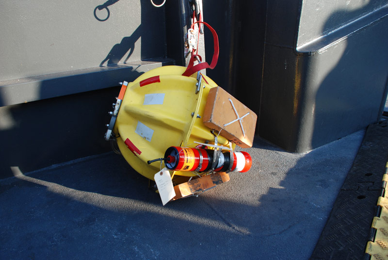
The stationary transponder (red cylinder) is attached to a floatation and release mechanism. Image courtesy of the Exploring Carolina Canyons expedition. Download larger version (jpg, 4.6 MB).
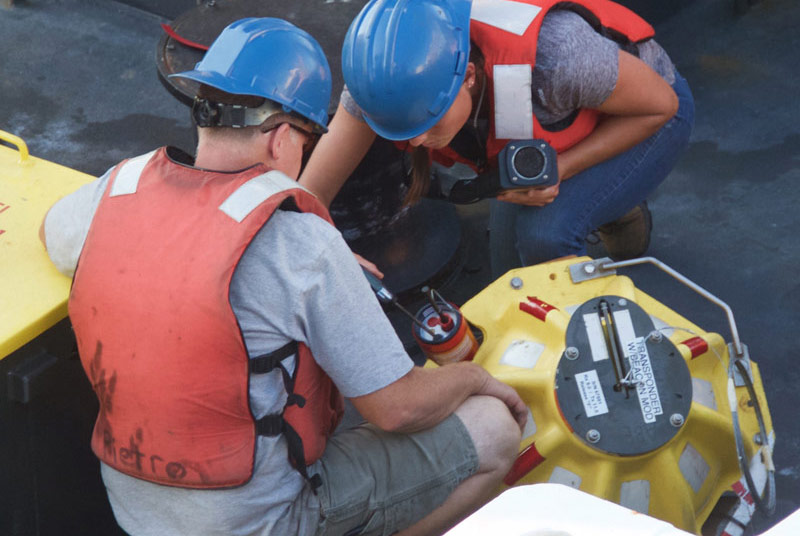
Mike McCarthy and Molly Curran of the AUV team prepare the stationary transponder for deployment. Image courtesy of the Exploring Carolina Canyons expedition. Download larger version (jpg, 1.8 MB).
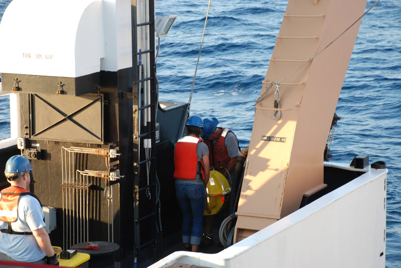
Mike McCarthy and Molly Curran of the AUV team carry the stationary transponder to the stern of the ship for deployment. Image courtesy of the Exploring Carolina Canyons expedition. Download larger version (jpg, 3.7 MB).
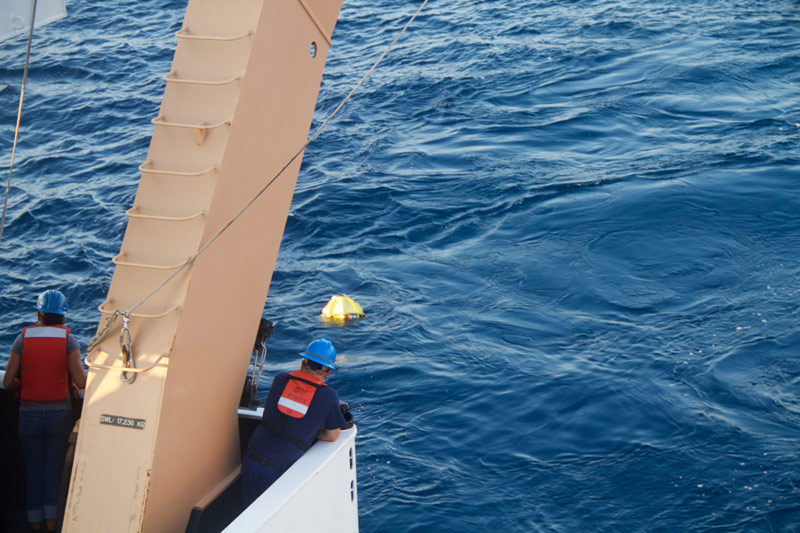
The stationary transponder is successfully deployed in the water. Image courtesy of the Exploring Carolina Canyons expedition. Download larger version (jpg, 6 MB).