By Brian Cousin, Video Production Specialist - Harbor Branch Oceanographic Institute, Florida Atlantic University
August 13, 2013

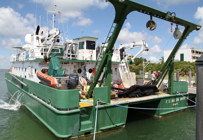
The R/V F.G. Walton Smith ready to get underway. The A-frame on the stern will be used to launch scientific packages including the MOCNESS system and the Remotely Operated Vehicle. Her wide breadth helps make her stable on the water. Image courtesy of Brian Cousin, Harbor Branch Oceanographic Institute, Florida Atlantic University. Download larger version (jpg, 846 KB).
The R/V F.G Walton Smith is ’pulling at the lines’, ready to get away from the dock. It’s the tidal current, which is substantial, but all hands are on-board and ready to get underway. We’re waiting now for the high tide that the research vessel needs to escape land without hitting any submerged part of it. The science crew, assembled from various home ports, is busy setting up equipment in the shipboard lab. It’s a big common space where everyone works side-by-side: perfect for a cruise focusing on ecosystem connectivity.

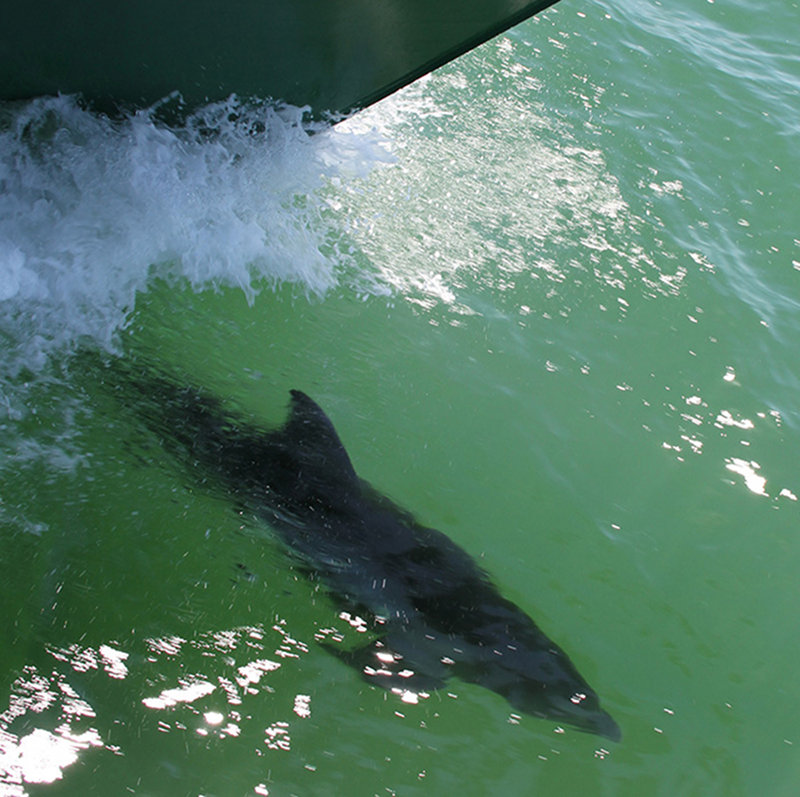
An Atlantic bottlenose dolphin rides the bow wave on the R/V F.G Walton Smith. At times, several dolphins at once can be seen enjoying the push of water and may stay around for a few seconds to a number of minutes. Image courtesy of Brian Cousin, Harbor Branch Oceanographic Institute, Florida Atlantic University. Download larger version (jpg, 756 KB).
The Research Vessel F.G. Walton Smith is owned and operated by the University of Miami’s Rosenstiel School of Marine and Atmospheric Science (RSMAS) and is a member of the University National Oceanographic Laboratory System (UNOLS) fleet. It’s also our home for the next 2 weeks. Thirteen science crew and 8 ships crew will eat, sleep and work with and around each other on this unique 96’ twin-hull vessel. Thanks to a 40’ breadth, there is good deck space for deploying our Remotely Operated Vehicle (ROV), Multiple Opening and Closing Net with Environmental Sensing System (MOCNESS), fish traps, plankton traps, Conductivity/Temperature/Depth (CTD) rosette and more.

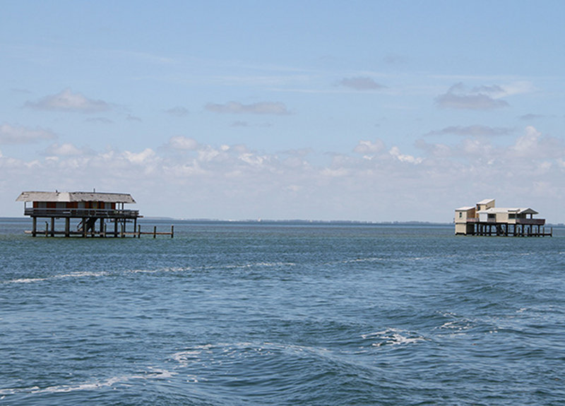
’Stiltsville’ is a collection of houses built on the sand banks edging Biscayne Bay. A number were damaged or destroyed in hurricane Andrew in 1991. Commuting to and from these homes can be rough in bad weather, but there is ample parking and no rush hour congestion. Image courtesy of Brian Cousin, Harbor Branch Oceanographic Institute, Florida Atlantic University. Download larger version (jpg, 708 KB).
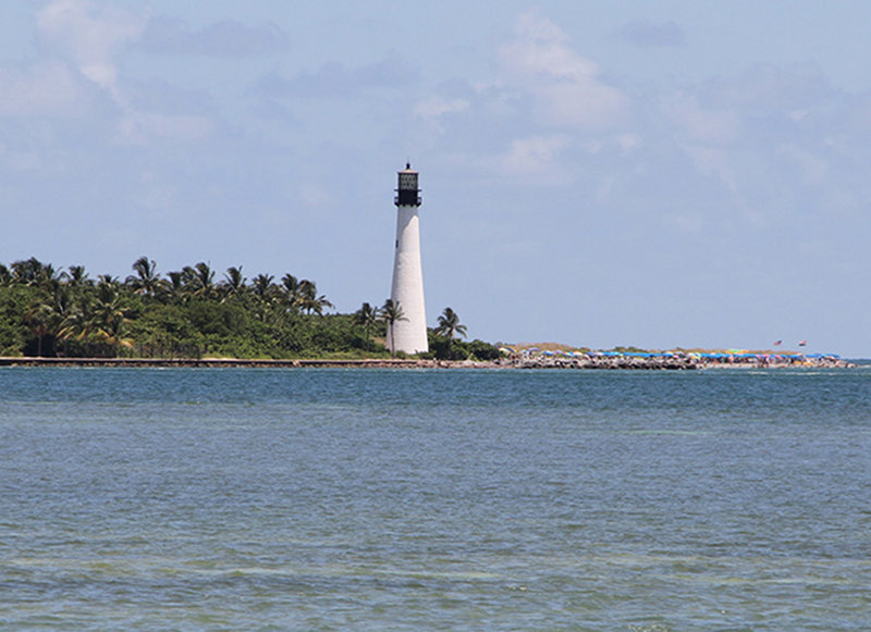
We cast off just after 11 a.m., leaving UM RSMAS and the city of Miami over the horizon. We headed south, then turned westward toward the Dry Tortugas and Pulley Ridge. We passed through Stiltsville, a group of stilt houses in Biscayne Bay, and motored past the Cape Florida Light located in Bill Baggs Cape Florida State Park. The original light was built in 1825 and rebuilt in 1846. It was decommissioned in 1878. One hundred years later, in 1978, the United States Coast Guard restored the lighthouse to active service. It was again decommissioned in 1990.

The Cape Florida Lighthouse is the oldest standing structure in Miami-Dade County. Image courtesy of Brian Cousin, Harbor Branch Oceanographic Institute, Florida Atlantic University. Download larger version (jpg, 766 KB).
We’ll follow Hawk Channel, which runs between the islands of the Florida Keys and the reef line to Key West. After that, Captain Shawn Lake will decide on the best course to our destination. Our total transit time will be approximately 27 hours. We’ll commence with scientific activities immediately upon reaching station. The science crew is situated for what will be a full two weeks of scientific endeavor on Pulley Ridge. Stay connected at NOAA Ocean Explorer.