By Sandra Brooke - Marine Conservation Institute/OIMB
and Amanda Demopoulos - U.S. Geological Survey

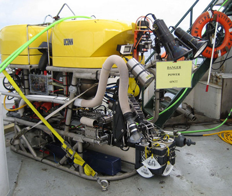
The ROV Kraken II on the deck of the ship showing its manipulator arm and suction tube for collecting samples. The ROV is equipped with a variety of containers for bringing samples to the surface in good condition. Image courtesy of Steve Ross, UNCW. Download image (jpg, 127 KB).
This project has a wide variety of scientific objectives that investigate biology and ecology of different types of seafloor communities, oceanography and archeological sites within and adjacent to deep-water canyons off Virginia and Maryland. The 2012 research cruise (August 15th to September 30th) will be divided into three separate legs; the first two will explore natural ecosystems and habitats found within the canyons, and the third will examine historical shipwrecks and their biological communities.
In order to maximize valuable ship time, we will be conducting 24-hour operations. During the daytime we will use the ROV Kraken II to survey biological communities associated with different canyon habitats, including hard-bottom habitats in search of deep-sea corals, soft sediments in the canyon axis, and consolidated clay outcroppings on the canyon walls. The video footage and digital images will be used to characterize the different habitats and document the distribution and biodiversity of canyon communities. In addition to video surveys, the ROV will be used to collect samples of deep-water corals, other canyon fauna, and sediment cores. During the night, we will supplement the ROV samples by using boxcores and small trawls to collect additional fauna and sediments. These collections will be used to address multiple objectives including understanding the community structure, taxonomy, age, growth, reproductive biology, and genetic connectivity of deep-sea canyon organisms, their associated microbiology and food webs. In addition, sediments will be examined to better understand the geological and physical environment of canyons.

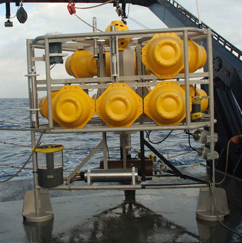
One of the Benthic Landers we will be deploying during the first leg of the cruise. This is a platform that can be deployed from the ship and recovered by remotely releasing the weight that secures it to the seafloor. The four Landers and two moorings will be equipped with instruments to measure environmental variables and rate of sediment deposition. Image courtesy of Steve Ross, UNCW. Download image (jpg, 75 KB).
Deep-sea studies are limited by the short duration of their field work; research cruises are expensive and are usually 2-4 weeks long. This provides scientists with just a ‘snapshot’ of information, but in order to understand how biological communities function, we need to know more about the environment they live in. These data are generally not available for deep sea habitats. One of the most exciting objectives of this project is the application of sophisticated technology, deployed on platforms called Benthic Landers and sediment trap moorings to provide long-term data and monitoring of these environments. The Landers and sediment traps will be placed at the head, middle, and the base of Norfolk and Baltimore canyons, where they will remain for a year, collecting data on temperature, salinity, oxygen, chlorophyll, currents and monthly sediment deposition. The Landers will also be equipped with a series of settlement plates to assess recruitment and colonization rates of benthic fauna, and experiments to measure growth and survival of deep-water corals. Data collected by these instruments and experiments will advance our understanding of the biology, ecology, and oceanography of canyons by bridging the gap between sampling cruises.

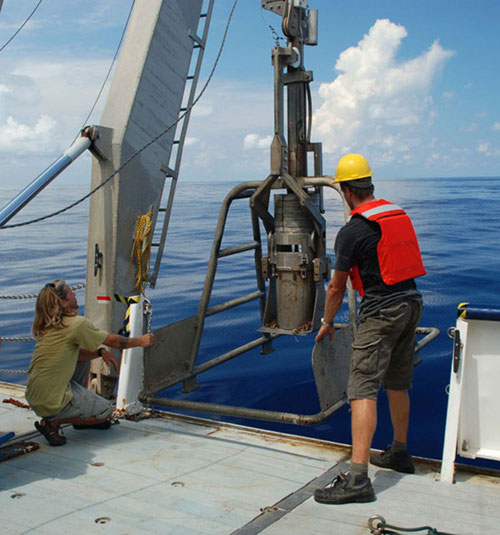
This image shows the boxcore being recovered off the starboard side of the ship to collect deep sea sediment. This equipment grabs a column of sediment and the overlying water and brings it intact to the surface. Image courtesy of Steve Ross, UNCW. Download image (jpg, 69 KB).
The focus of the third cruise leg will be to locate and survey historical shipwrecks with the ROV, and use the video and images to determine the type, mission, ownership, construction period, cause of sinking and cargo of the ships. In addition, images of the shipwrecks will be stitched together in order to construct a digital photo archive of these historic structures. If eligible, the shipwrecks will be proposed for nomination to the National Register of Historic Places. The shipwrecks will also be assessed for their value as artificial habitat for canyon fauna by comparing the fishes and invertebrates associated with the wrecks to those found in natural habitats. In addition to the shipwrecks, the marine archaeologists on board will be searching for evidence and possibly artifacts of pre-historic habitation sites.