
By Susan Merle, Senior Research Assistant - Oregon State University, CIMRS Program, NOAA Vents Program, Pacific Marine Environmental Laboratory
and Kyle Carothers, Ocean Explorer Web Site Production Manager - NOAA Office of Ocean Exploration and Research
Explore the volcanoes of the Submarine Ring of Fire 2012: Northeast Lau Basin expedition by watching 3D fly-throughs created using satellite bathymetry data.
Fly-through from the south toward the north along the Lau basin. The blue squares signify proposed remotely operated vehicle dive sites during the SRoF’12 expedition. Colors vary from cool (blues) to warm (red/pink), representing deep and shallow respectively. Islands are black. Satellite altimetry data (coarser bottom layer) is overlaid with higher resolution multibeam bathymetry, much of which was compiled by Fernando Martinez, University of Hawaii. The satellite altimetry data are courtesy of Smith and Sandwell, 1997. Seafloor data are 2 times vertically exaggerated. Fly-through created by Susan Merle OSU / NOAA Vents Program. Download (mp4, 27.0 MB).
Fly-through from the north to the south along the Northeast Lau basin. The blue squares signify proposed remotely operated vehicle dive sites during the SRoF’12 expedition. This flight starts at the Tonga trench, passes over the North Matas, West and East Mata, Niua, and ends at Volcano O. Colors vary from cool (blues) to warm (red/pink), representing deep and shallow respectively. Islands are black. Satellite altimetry data (coarser bottom layer) is overlaid with higher resolution multibeam bathymetry data collected on recent expeditions to the area. The satellite altimetry data are courtesy of Smith and Sandwell, 1997. Seafloor data are 2 times vertically exaggerated. Fly-through created by Susan Merle OSU / NOAA Vents Program. Download (mp4, 16.9 MB).
3D images slideshow of the Submarine Ring of Fire 2012: Northeast Lau Basin proposed remotely operated vehicle dive sites. All images are two times vertically exaggerated. Most of the bathymetry data is higher resolution multibeam (EM300 and EM122), 35-meter grid-cell size.

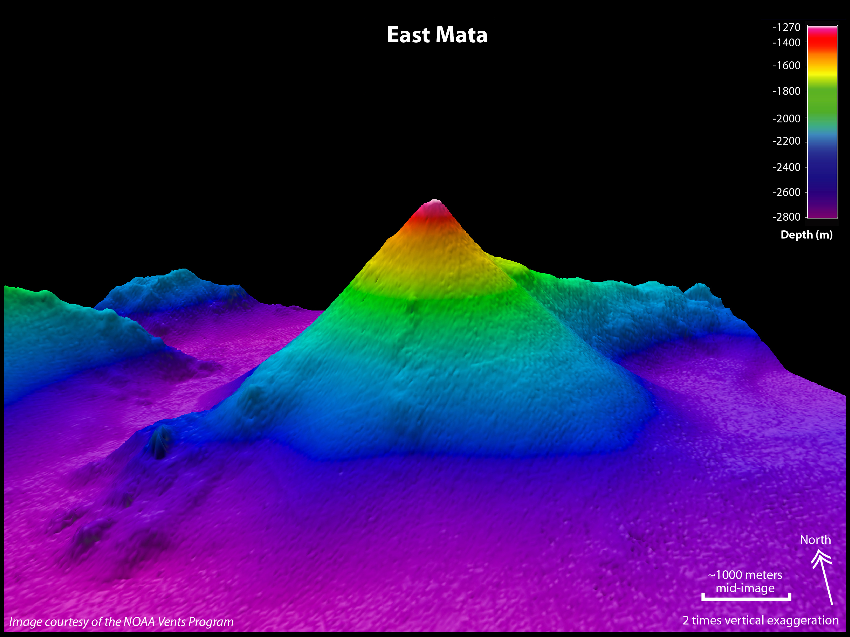
East Mata volcano. Image is looking toward the north, 2 times vertically exaggerated. EM122 multibeam bathymetry grid cell size is 35 meters. Image courtesy of Submarine Ring of Fire 2012 Exploration, NOAA Vents Program. Download larger version (jpg, 2.0 MB).

Fonualei South spreading center. Image looks toward the south, 2 times vertically exaggerated. EM122 multibeam bathymetry grid cell size is 35 meters. Image courtesy of Submarine Ring of Fire 2012 Exploration, NOAA Vents Program. Download larger version (jpg, 2.0 MB).
")
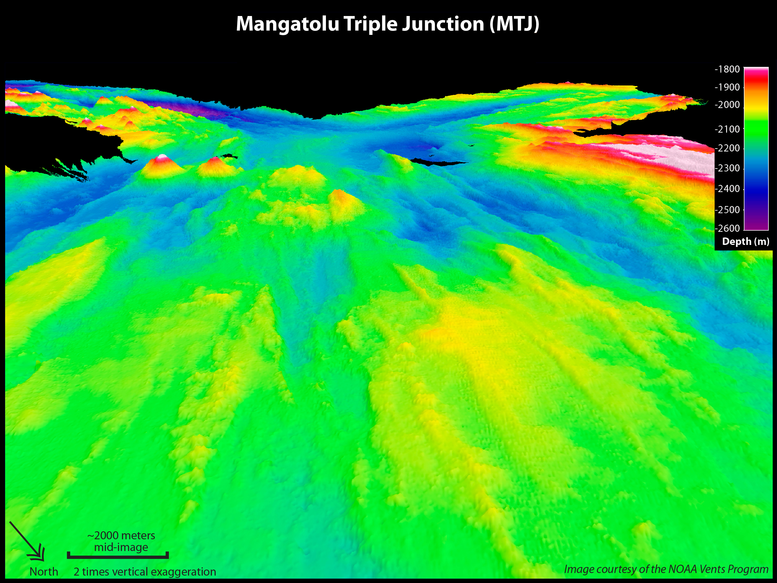
Mangatolu triple junction. Image looks toward the southwest, 2 times vertically exaggerated. The proposed dive site is mid-image. The triple junction is in the background. EM300 multibeam bathymetry grid cell size is 35 meters. Image courtesy of Submarine Ring of Fire 2012 Exploration, NOAA Vents Program. Download larger version (jpg, 3.6 MB).

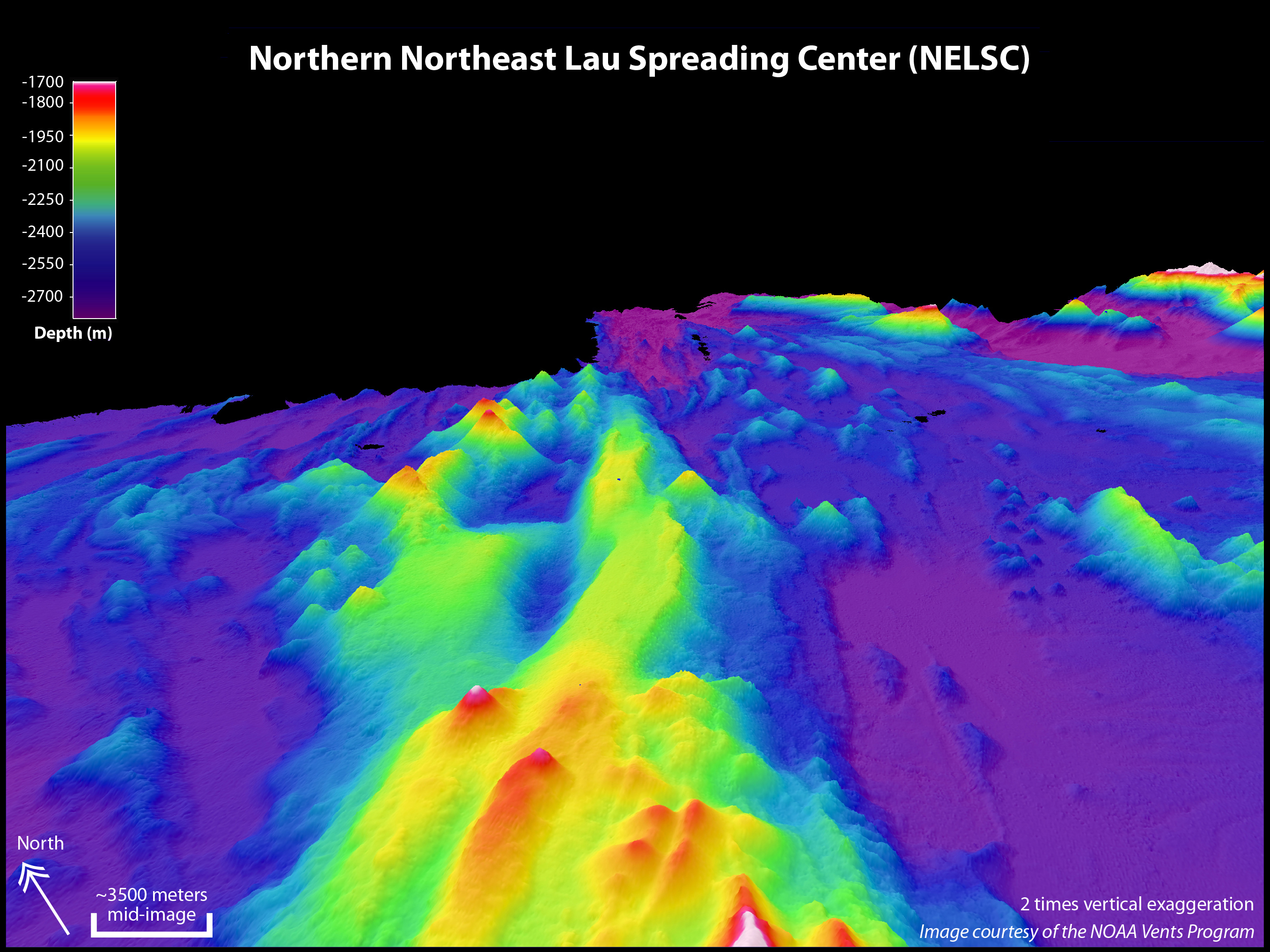
Northern Northeast Lau spreading center (NELSC). Image looks toward the northeast, 2 times vertically exaggerated. EM300 multibeam bathymetry grid cell size is 35 meters. Image courtesy of Submarine Ring of Fire 2012 Exploration, NOAA Vents Program. Download larger version (jpg, 3.0 MB).

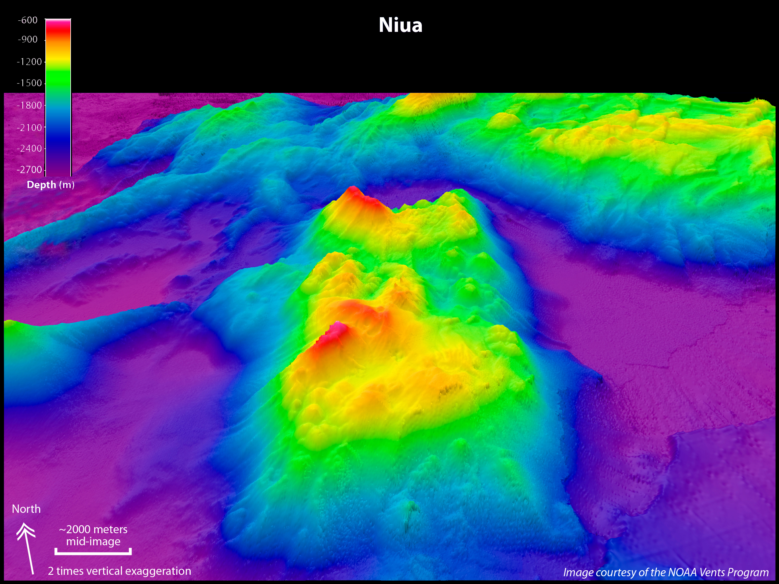
Niua volcano in foreground. Image looks toward the north/northeast, 2 times vertically exaggerated. EM300 and EM122 multibeam bathymetry grid cell size is 35 meters. Image courtesy of Submarine Ring of Fire 2012 Exploration, NOAA Vents Program. Download larger version (jpg, 3.6 MB).

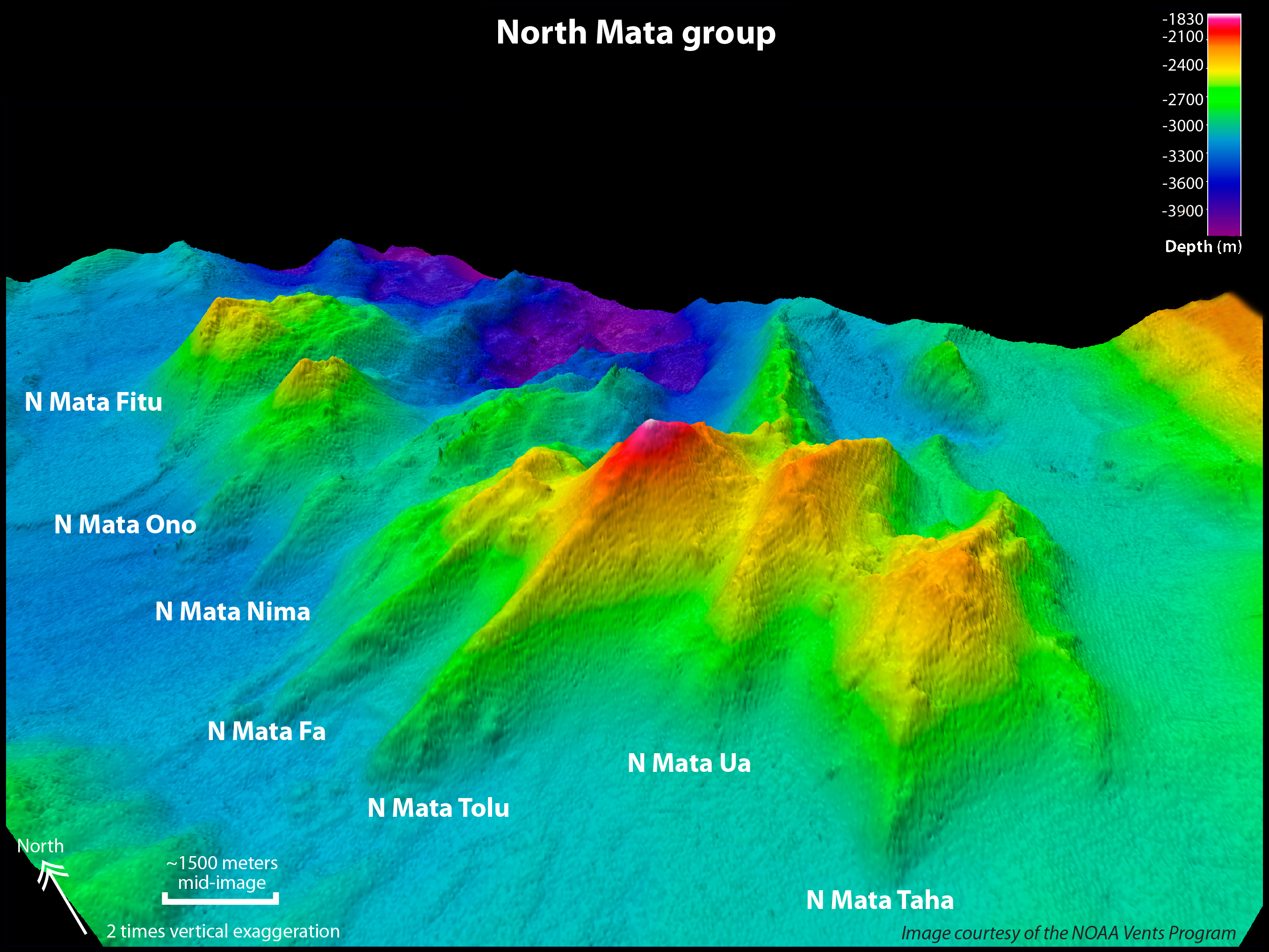
The North Mata group of volcanoes. Image looks toward the northeast, 2 times vertically exaggerated. 6 of these 7 seamounts were found to have hydrothermal activity during an expedition in 2010. EM300 and EM122 multibeam bathymetry grid cell size is 35 meters. Image courtesy of Submarine Ring of Fire 2012 Exploration, NOAA Vents Program. Download larger version (jpg, 3.2 MB).

Vai Lili hydrothermal vent site located on the Valu Fa ridge, Eastern Lau spreading center (ELSC). The image looks toward the south, 2 times vertically exaggerated. SeaBeam multibeam bathymetry grid cell size is 50 meters. Image courtesy of Submarine Ring of Fire 2012 Exploration, NOAA Vents Program. Download larger version (jpg, 3.5 MB).

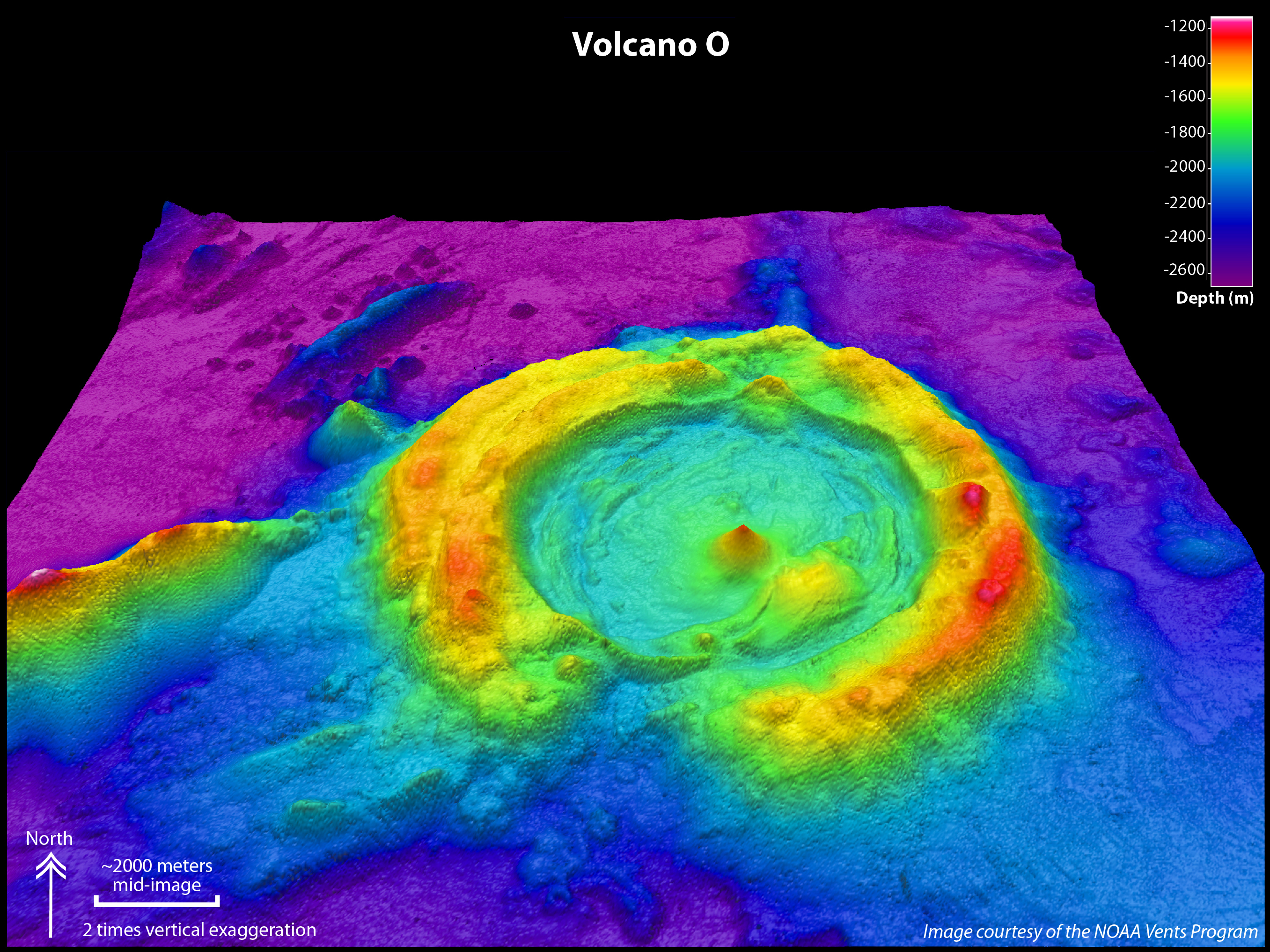
Volcano O, a huge caldera in the Northeast Lau Basin. Image looks toward the north, 2 times vertically exaggerated. EM300 and EM122 multibeam bathymetry grid cell size is 35 meters. Image courtesy of Submarine Ring of Fire 2012 Exploration, NOAA Vents Program. Download larger version (jpg, 4.2 MB).


