

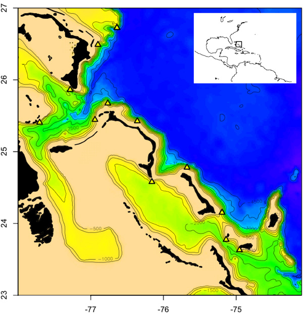
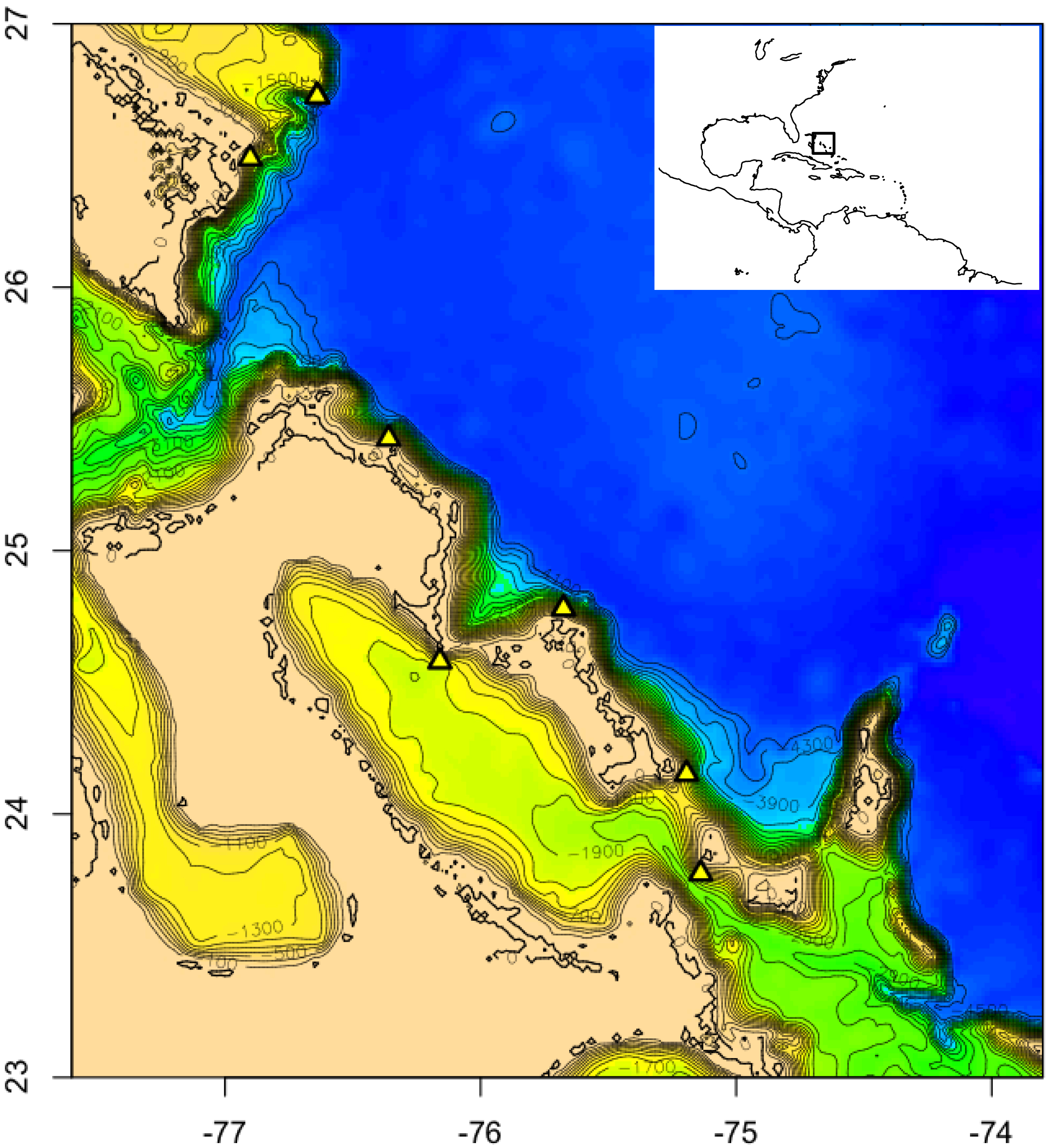
A bathymetric (water depth) map of the northern Bahamas (inset shows area of detail) with colors indicating different depth zones: blues are the deepest (greater than 3,000 meters/9,843 feet), yellow-to-green intermediate (500 to 2,500 m/1,640 to 8,202 ft), and beige shallowest (500 m/1,640 ft); islands are shown in black. Our 12 dive sites are indicated by the yellow triangles. Map figure by Eric Pante. Image courtesy of Bahamas Deep-Sea Coral Expedition Science Party, NOAA-OE.
Related Links