


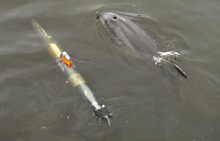
A Gavia autonomous underwater vehicle (AUV) swims with a dolphin. Click image for larger view and image credit.
Mission Plan
Mark Patterson
Bonaire Expedition Leader
Associate Professor of Marine Science
Director, Autonomous Systems Laboratory
Virginia Institute of Marine Science, College of William & Mary
Arthur Trembanis
Project Co-principal Investigator – AUV Operations/Marine Geologist
Assistant Professor
University of Delaware
Jim Leichter
Project Co-principal Investigator –Biological Oceanographer
Associate Professor
Scripps Institution of Oceanography
University of California at San Diego
Dale Stokes
Project Co-principal Investigator – Physical Oceanographer
Associate Research Oceanographer
Scripps Institution of Oceanography
During the end of December through the first few days of the New Year, an advance team will arrive in Bonaire, meet with local government officials, start the process of getting our mountain of gear through customs, scout dive locations and autonomous underwater vehicle (AUV) launch sites, and generally get the "lay of the land." During the first full week of January, the rest of the team will arrive, assemble and test the three AUVs, and begin diving operations using Nitrox scuba.
The initial plan is to survey areas that likely have seen development over the past 25 years and compare them to less developed or undeveloped sections of the coastline. A typical operations day will have the three AUVs in the water in the morning and they will dive until noon or early afternoon. The Fetch1 AUV will run linear transects from shallow to deep water at many of the van Duyl sites, using high frequency side scan sonar, underwater video, and water quality sensors. The two Gavia AUVs will run lawnmower patterns at select locations along the leeward side of Bonaire and Klein Bonaire, including sites of special interest to the territorial government of Bonaire. These AUVs will run their multibeam sonars, underwater video, and water quality sensors.
At most of the AUV sites, during the afternoon, we plan to send Nitrox scuba divers into the water to perform close-up video surveys, and later in the month, visual fish transects. The video footage of the AUVs from deeper water (60 to 100 meters/197 to 328 feet) will also be analyzed for sites likely to contain new species or interesting bottom-type communities. These pre-identified hotspots are where we will send our technical diving team who will use trimix to reach these deeper areas of the reef. Operations will begin toward the middle of the month. We also will deploy bottom-mounted instruments to measure water currents and a sophisticated array for measuring temperatures near the reef at two locations. Deep reef operations will continue through the end of the month.
As the mission progresses, we will post data, including preliminary maps, images and videos, to the NOAA Ocean Explorer Web site.
Sign up for the Ocean Explorer E-mail Update List.