

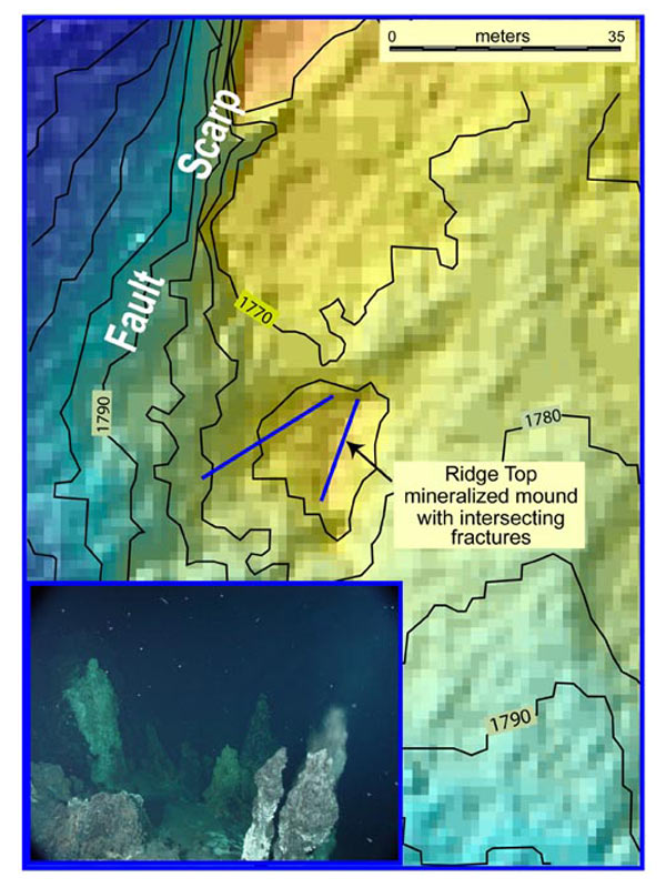
Map shows high resolution bathymetry collected from ABE in 2002 on Explorer Ridge, NE Pacific. Contours are at 5 meter intervals. The mineralized mound consists of a base of metallic sulfide debris topped by small active chimneys composed of sulfide and sulfate minerals. The pixel size for the SM2000 multibeam bathymetry is 1 meter. This clearly shows the intersecting fracture pattern forming the mound that can also be seen on the photograph below taken by the ROPOS remotely operated vehicle at approximately the position shown by the arrow (looking N-NE). Two lines of chimneys converge from left and right (W and E). In contrast, the effective pixel size of the multibeam data collected by the surface vessel is 35 meters, the length of the scale bar. Image courtesy of New Zealand American Submarine Ring of Fire 2007 Exploration, NOAA Vents Program, the Institute of Geological & Nuclear Sciences and NOAA-OE.
Related Links
New Zealand American Submarine Ring of Fire 2007
New Zealand American Submarine Ring of Fire 2007: AUV Mapping