

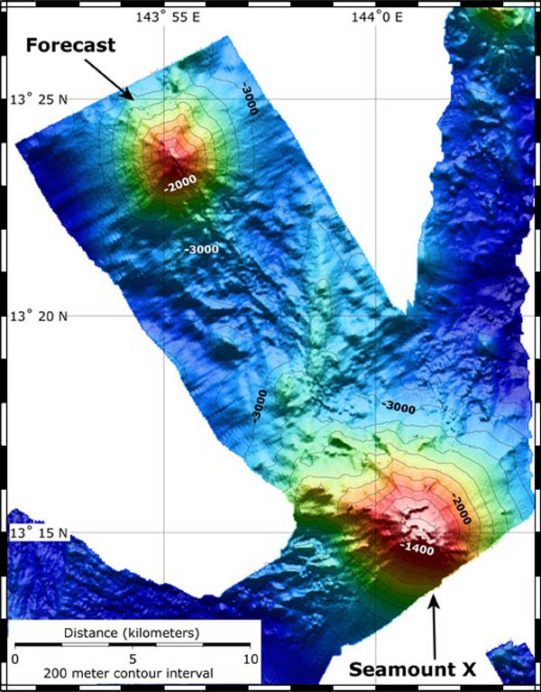
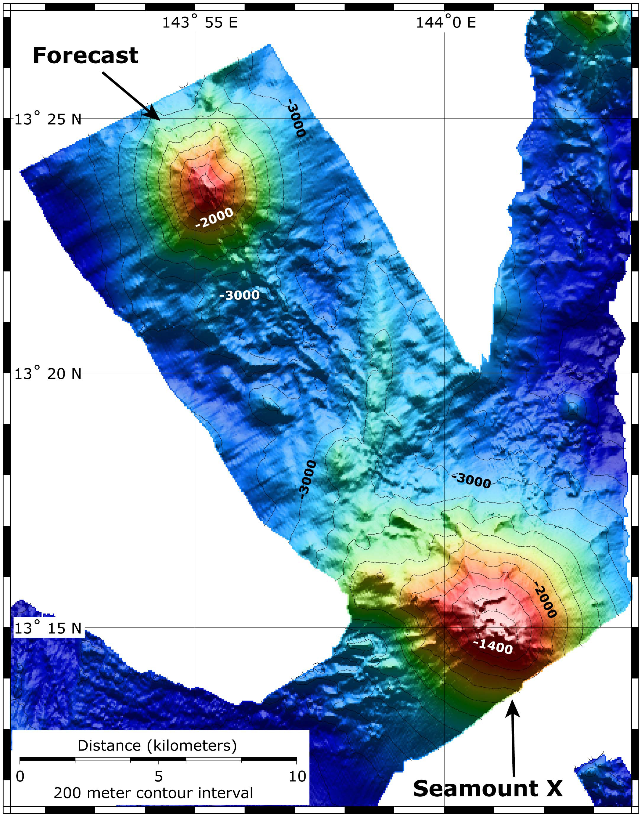
This map shows the location and topography of Seamount X and Forecast. The bathymetry data are a combination of EM300 bathymetry collected on the Submarine Ring of Fire 2004 expedition, and SeaBeam bathymetry collected on this expedition, just prior to diving on Forecast. The contour interval is 200 m; the grid cell size is 50 m. Image courtesy of Submarine Ring of Fire 2006 Exploration, NOAA Vents Program