

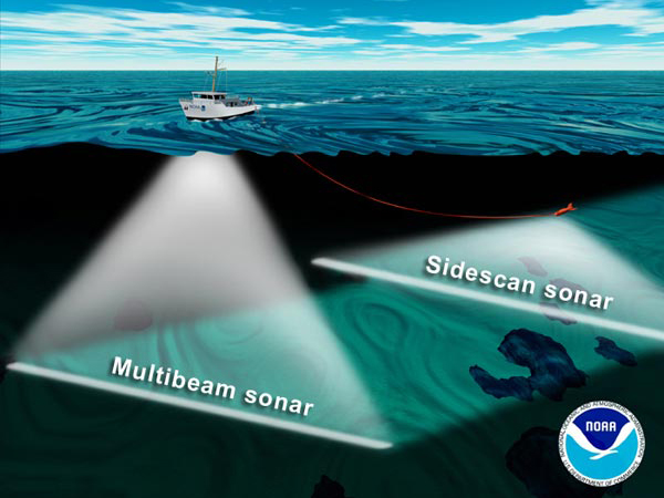
During the GalAPAGoS expedition, we will be using two types of sonars to acoustically map seafloor features. The EM-300 sonar uses an array of 30 KHz sound sources and receivers mounted on the hull of the ship. This "multibeam" sonar array maps the depth of the seafloor beneath the ship across a swath ~4 km wide at ridge crest depths. To image even smaller seafloor features, we will tow the DSL-120 kHz sonar close to the seafloor. The DSL-120 has two sonars that look out to each side, and a third that looks straight down. These three sonars map seafloor depth to within 1-2 m accuracy, and also measure the amount of sound that is reflected from the seafloor ("acoustic reflectivity"). Image courtesy of NOAA.
Related Links
GalAPAGoS: Where Ridge Meets Hotspot
GalAPAGoS: Where Ridge Meets Hotspot: Mission Plan