

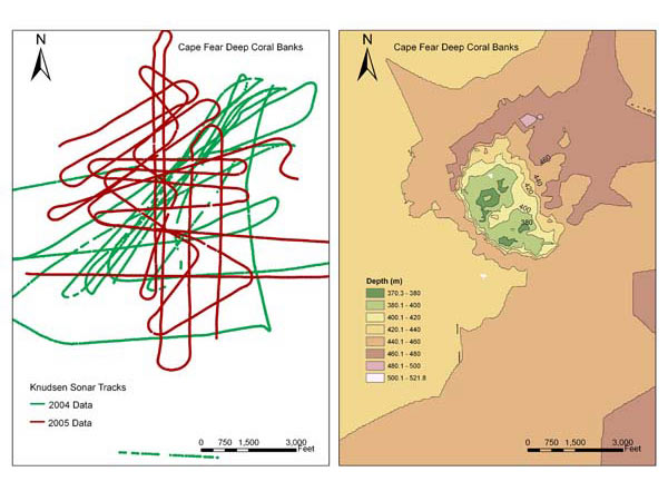
Two years of ship tracks plotted over the Cape Fear deep coral bank area off North Carolina, illustrating dense coverage of single beam sonar (left panel). Using those data allowed a plot of depth zones in detail. Image courtesy of Ross et al.
Related Links
Life on the Edge 2005: Oct 30 Log
Download high-resolution image (jpg, 612 Kb)