

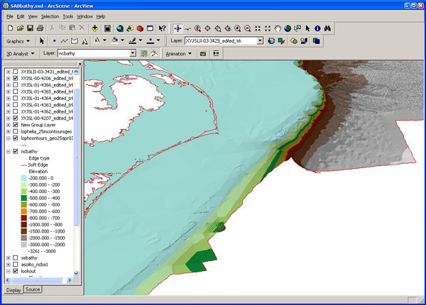
Figure 4. Screen capture of the 3-D mapping program, ArcScene. In this program bathymetric data can be turned into realistic surfaces over which information collected during the dives (or other sample collections) can be projected, rotated, queried and interpreted. Displayed here is the continental shelf break off of Cape Hatteras. Image courtesy of Ross et al., NOAA-OE, HBOI.
Related Links
Life on the Edge 2005: Oct 19 Log