

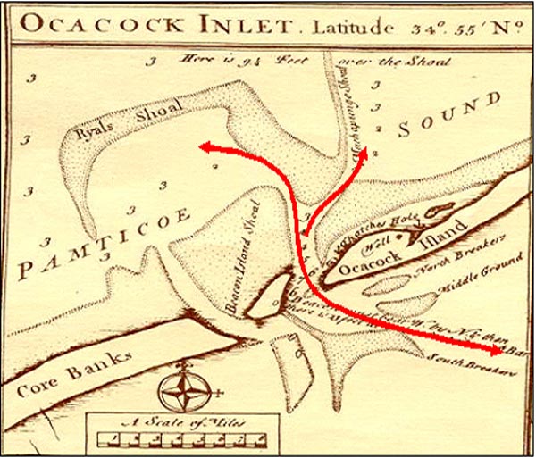
Ocracoke Inlet, North Carolina is shown on Edward Moseley's map of 1733. This map, when compared with other historic maps, enabled researchers to determine how the inlet has changed over several hundred years. Some shipwrecks are no longer in or near the present inlet. The map clearly shows the obstructions at the mouth of the inlet that caused numerous ships to run aground.
Related Links