
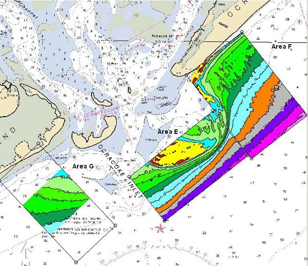
Bathymetric map of areas surveyed for shipwrecks at the entrance to Ocracoke Inlet on the Outer Banks of North Carolina Image courtesy of Ocracoke 2004 Exploration, ECU, NOAA-OE
Related Links

Bathymetric map of areas surveyed for shipwrecks at the entrance to Ocracoke Inlet on the Outer Banks of North Carolina Image courtesy of Ocracoke 2004 Exploration, ECU, NOAA-OE
Related Links