

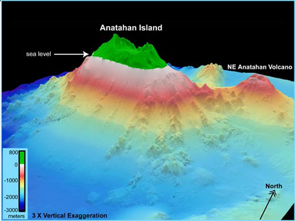
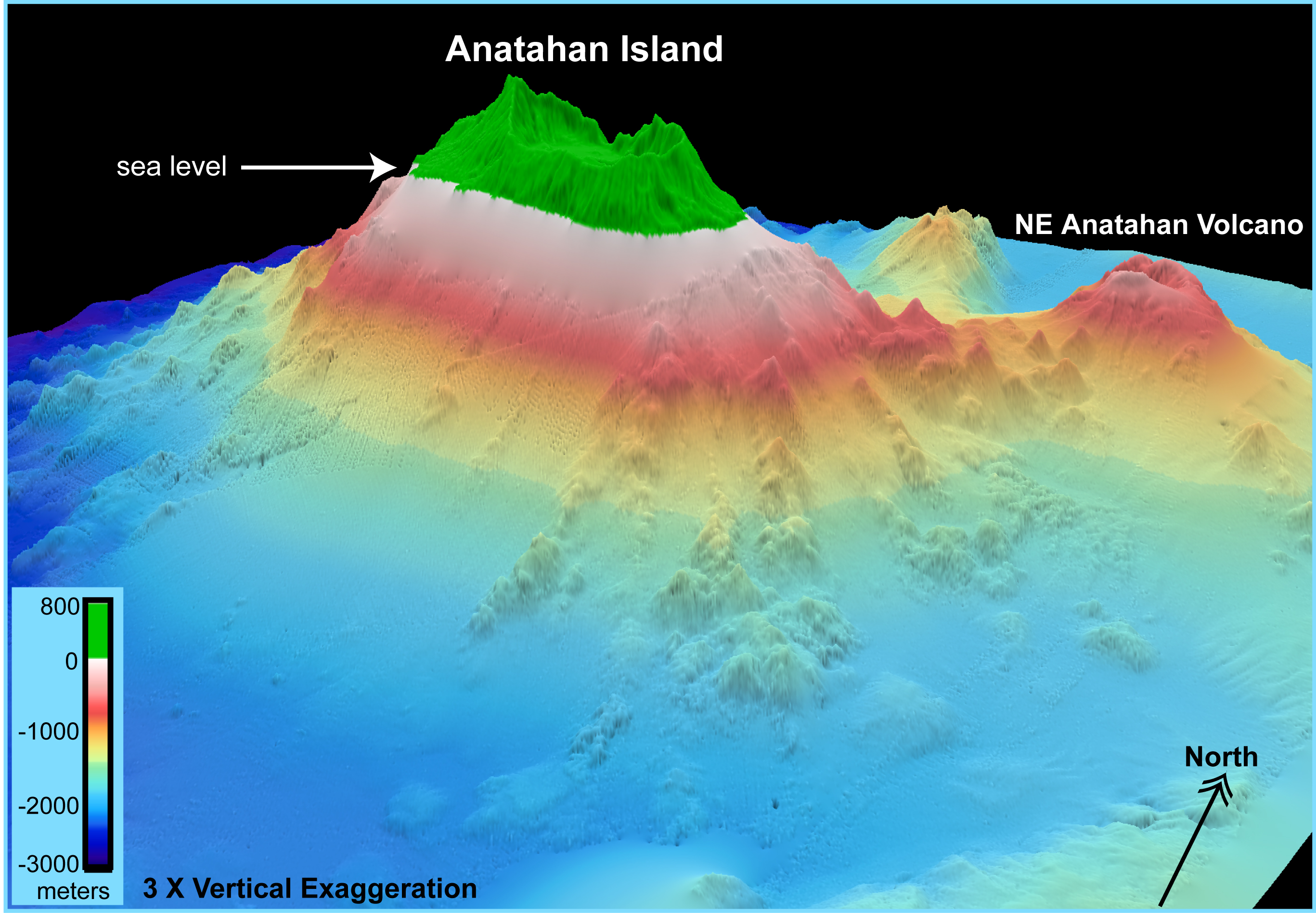
EM300 and SB2000 multibeam bathymetry (35-m grid) is shown in the vicinity of Anatahan Island. The view is looking north-northwest toward the island's southern flank. Anatahan Island is ~9 kilometers in length. The SB2000 data were collected by R. Dziak. The digital elevation model of Anatahan Island was created by Steve Schilling (U.S. Geological Survey) and geo-referenced with control points provided by Frank Trusdell (U.S. Geological Survey).
Related Links
Submarine Ring of Fire 2004: Mapping
Download high resolution image (jpg, 1.8 Mb)