back banner Ocean Explorer Home Page NOAA home page

back arrow Back

map of the Blake Ridge Diapir


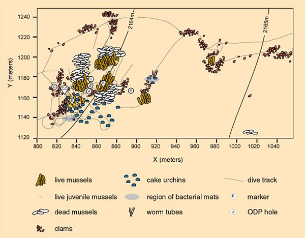
This map of the Blake Ridge Diapir shows the distribution of seep organisms, Alvin dive tracks, Ocean Drilling Program (ODP) sites (A through E, circle symbols), and markers (B through E, pie-shaped symbols) during dives in 2001 (Van Dover et al. (2003) Deep-Sea Research I 50, p. 287).


Related Links

Windows to the Deep Exploration

Windows to the Deep: July 26 Log

NOAA Ocean Explorer Gallery


E-mail Updates | User Survey | Report Error On This Page | Site Index | Contact Us
Revised July 12, 2005 by the Ocean Explorer Webmaster
National Oceanic and Atmospheric Administration | U.S. Department of Commerce
NOAA Logo Commerce Logo
http://oceanexplorer.noaa.gov/explorations/03windows/logs/jul26/media/blakeridgemap.html