

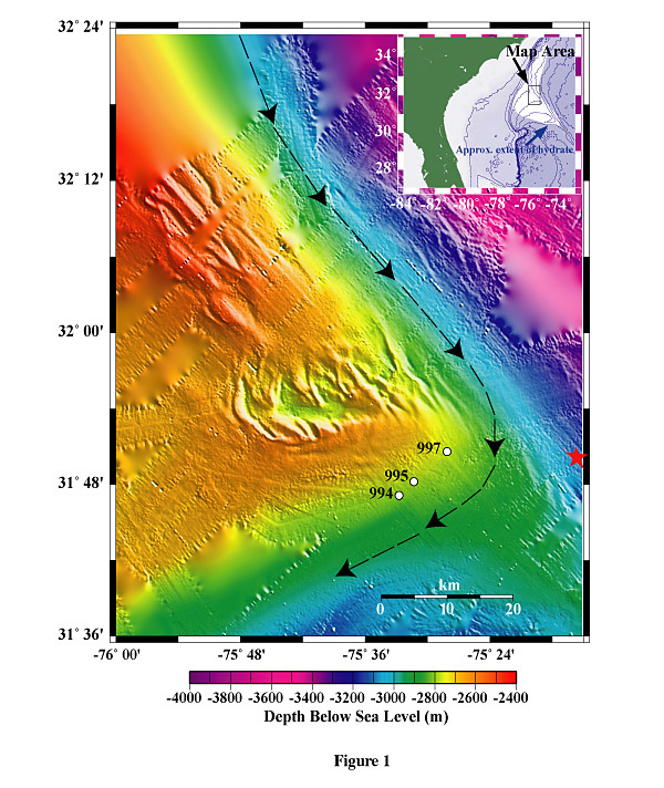
Bathymetric location map of the Blake Ridge study area produced from hydrosweep data obtained during a fall of 2000 cruise. The dashed arrows indicate the flow direction of the Western Boundary Undercurrent. White annotated circles denote Leg 164 drill sites 994, 995, & 997, where free gas and methane hydrate were recovered. The Red Star signifies the general location of the 1st Dive Site. Image by W.S. Holbrook.
Related Links
Windows to the Deep Exploration