

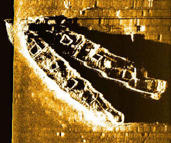
A side scan sonar image of the complete Palmer and Crary wrecksite provides a baseline map for ROV tracking. The Crary is the southern (bottom) ship and the Palmer lies to the north (top of picture.). Image courtesy of NOAA/NURC-UConn.
Related Links
Steamship Portland Exploration