

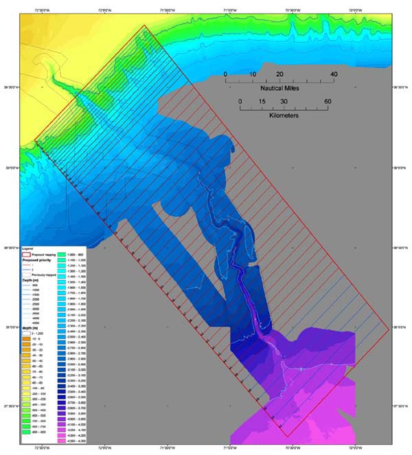
Image of tracklines and area being covered by the Hudson Canyon expedition. Each of the tracklines represent the path that the Ron Brown will follow as we continue with our swath bathymetric mapping of this 60 by 100 mile area. At our current pace of 10 knots, we are able to complete one trackline in roughly 6 hours . Image courtesy of Hudson Canyon Cruise 2002, NOAA/OER.