back banner
back button
spacer
ocean explorer home pageNOAA home page

Bathymetric map of Magic Mountain area


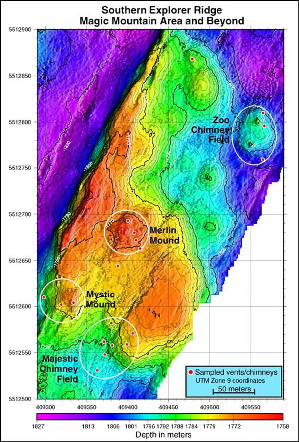
Bathymetric map of Magic Mountain area. Note the axial valley of Explorer Ridge in the upper left portion of the map. Vent fields are indicated by white circles. The red circles indicate some of the larger chimneys that were sampled on the Ocean Exploration expedition.


Related Links

Submarine Ring of Fire

Submarine Ring of Fire: Phase One Summary Log

Download high resolution image (jpg, 1.6 Mb)


E-mail Updates | User Survey | Report Error On This Page | Site Index | Contact Us
Revised July 11, 2005 by the Ocean Explorer Webmaster
National Oceanic and Atmospheric Administration | U.S. Department of Commerce
NOAA Logo Commerce Logo
http://oceanexplorer.noaa.gov/explorations/02fire/logs/yr_sum/media/magic.html