

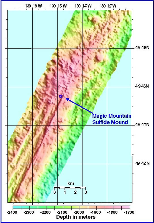
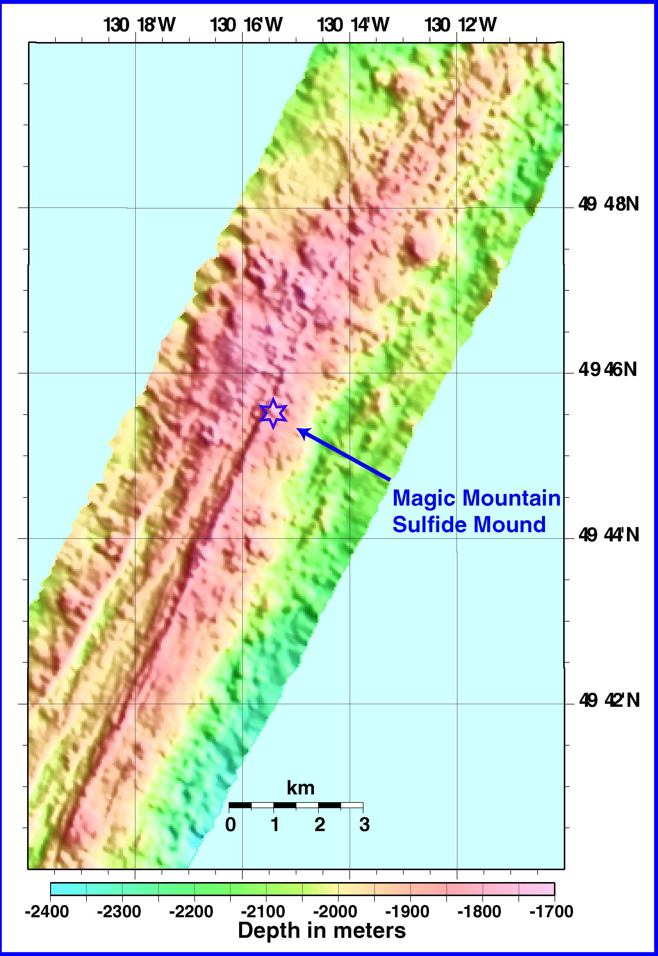
The first line of the EM300 (30 kHz) bathymetry survey over the main portion of Explorer Ridge. These data are mapped at 40 meter resolution. The map was used to determine the transponder positions, which ABE will be using for its high-resolution bathymetric survey (2 meter resolution or less). Image courtesy of Submarine Ring of Fire 2002, NOAA/OER.