


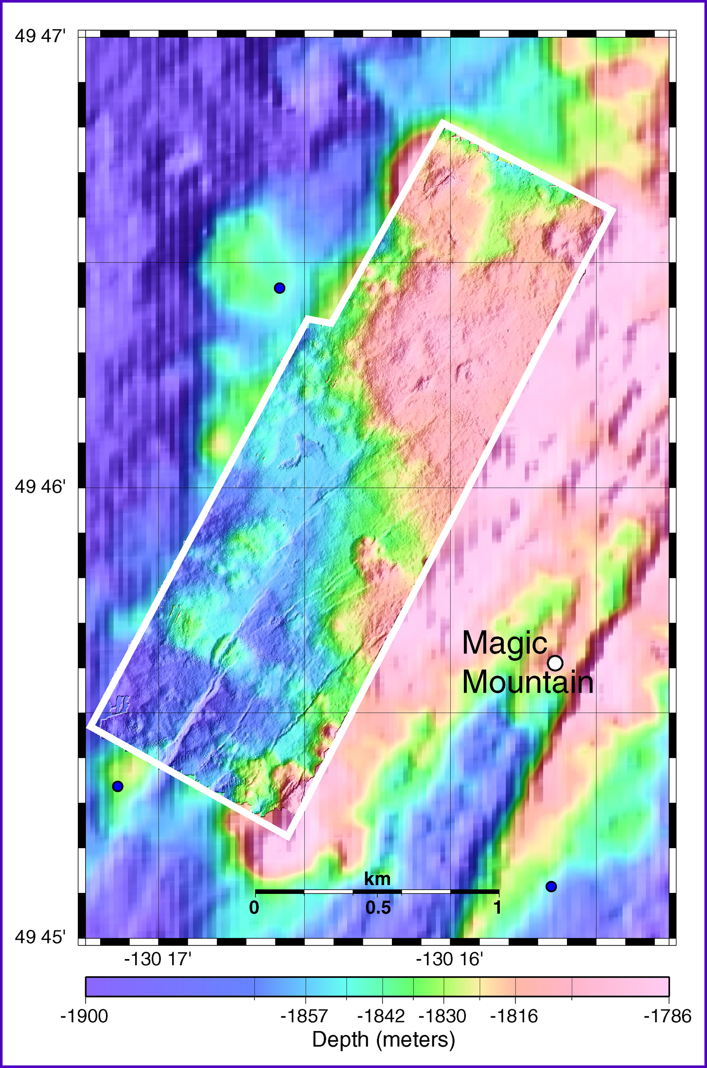
This map shows new high-resolution bathymetry (enclosed in white box) collected during ABE's first two dives overlain on lower-resolution bathymetry collected by the ship. The bathymetry collected by the ship is much better than that collected previously from this area, but the ABE bathymetry shows over 10 times more detail because it was collected near the seafloor (at 40 m altitude) instead of from the sea surface. On the other hand, the Thompson can survey large areas quickly, whereas ABE can only cover small areas with this kind of detail. The positions of Magic Mountain vent site and our transponders (blue circles) are also shown on the map. We will be adding to the ABE survey in the coming days including the Magic Mountain site. Image courtesy of Submarine Ring of Fire 2002, NOAA/OER.